
Bikepacking the Colorado Trail: Part 3
Day 4:Jefferson Cr. CG to Miners Creek Trail just past Breckenridge
Stats: 29.25mi, Elevation Gain: 4045ft, Moving Time: 5h14m, Elapsed time: 11h47m (including dinner stop)
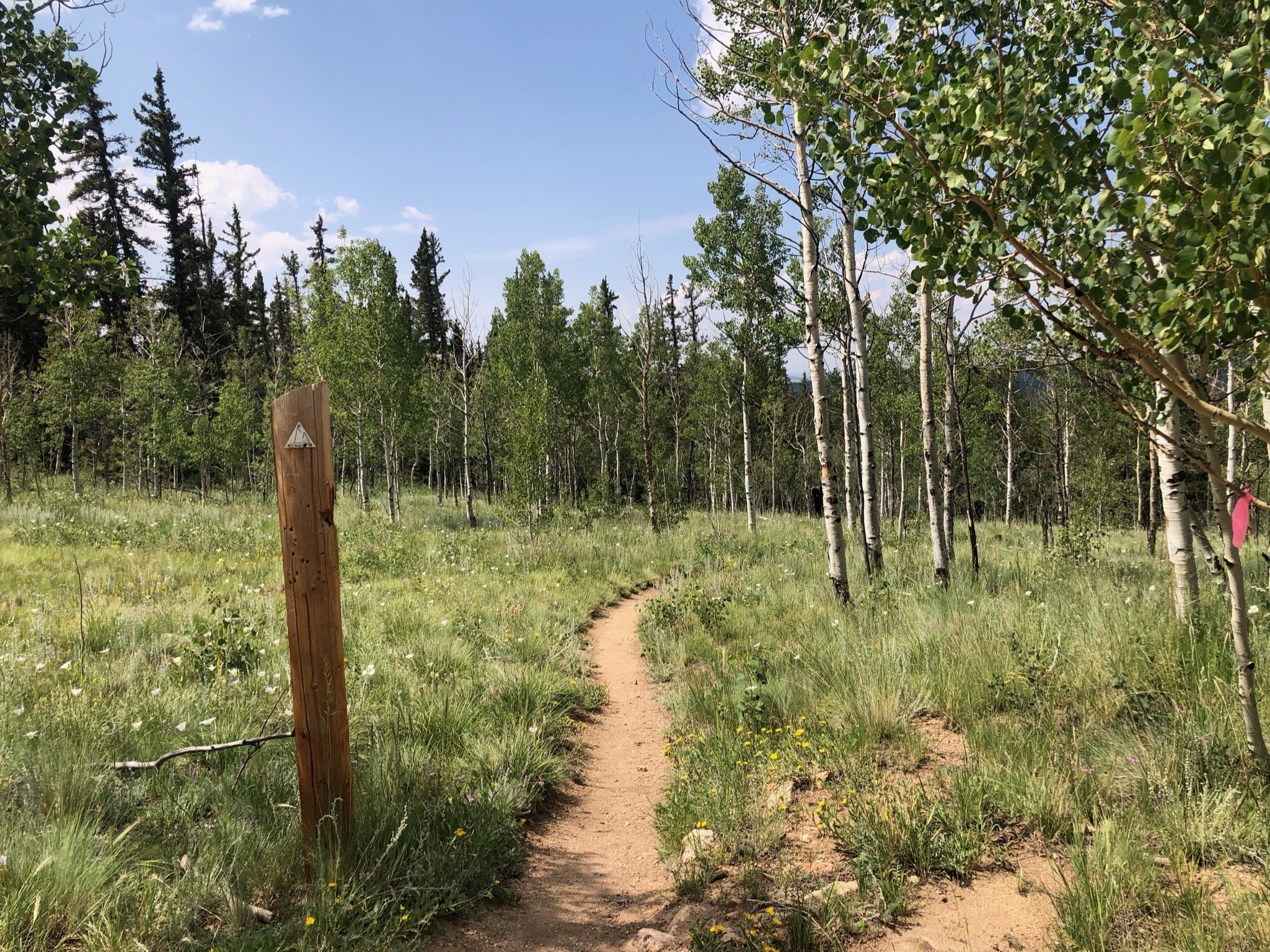
The morning started out beautifully. We had a lot of climbing to do in a short amount of miles, most of which were single track so we knew we were in for a big day. We were on the trail pretty early with some refreshed energy, which we would definitely need. We immediately started climbing up towards Georgia Pass. The clouds were grey and it was chilly, but not too bad as we got started. We expected that the climb would be difficult, but it was actually pretty rideable…until it wasn’t.


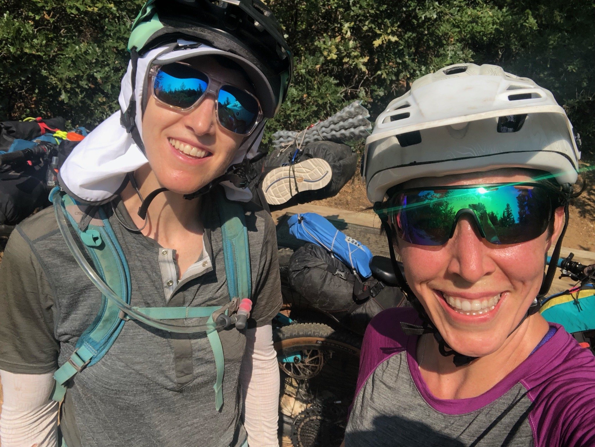
The trail turned from turned into baby heads, turned into goat heads, turned into boulders, even on the descent. From what I remember this didn’t last forever, though, and once started the descent proper down into Breckenridge, things turned for the better. We flew down the flowy descent, making all the switchbacks (for the most part) and had views for days. Our energy was pretty good, from what I remember, I think boosted by the fact that we’d have a good dinner in Breckenridge. At some point Aliza’s bike crank started having some issues, so we were in a rush to also get into town to make sure we could get to a bikeshop.


As we got off the trail to hop into town, it wasn’t obvious which way we needed to go right off the bat. We spent a bit of time faffing around because the bike/pedestrian path that is supposed to be the easiest way to get into town was closed for construction, so we were unsure what our options were. We connected with Patty Sag and made our way to Tiger road where he met us and we piled in the van. We were lucky that we made it when we did because sure enough, the thunderstorms moved in and the sky grew dark. We made the stops we needed for Aliza’s bike and to try to find me a handkerchief (failed attempt), and found a great spot for dinner, a couple of blocks off the main strip so it wasn’t as busy and we were able to immediately get a seat. As we were filling our bellies, the rain started to pour! I felt so glad to be inside and not shivering out there in the rain. Both Aliza and I knew, though, that from here on out we would be chasing storms for the rest of our trip, which we were not excited about!
It was getting late, so we picked up Aliza’s bike from the shop and Patty Sag took us over to the Peak’s Trailhead. He had suggested this way as the best way to get over to Miner’s trail where we would be camping. “It’ll be fun,” he said. “It’s not too climby,” he said… Half way through the up and downs of this “fun” trail, Aliza and I had cussed all the cuss words we could muster. Our legs, after spending a few hours at dinner, no longer felt the need to do what we needed them to. Plus the jump line we encountered on the trail wasn’t that spectacular on a hardtail 70lbs bike.
Either way, we finally made it to our camp just before dark. Tired, full, but warm, we set up camp quickly and fell asleep just our heads hit the pillow. The next day, we knew, would test our grit and stamina, so we needed to sleep well and get up early. As I was drifting off to la-la-land, I heard quiet voices and the sound of free-hubs next to our camp. Some of the racers who were traveling the opposite way as us were riding through the night. Glad to not be one of them, I drifted away and didn’t wake again until morning.


Day 5: Miners Crk to just below Searle Pass
Stats: 15 mi Elevation Gain: 4094ft, Moving Time: 4h32m Elapsed Time: 10hr05m

The weather had officially arrived. This day, we knew we needed to try to get over the pass and up 10-mile before the thunderstorms came in for the afternoon. We also knew that there would be much much hike-a-bike, but what we didn’t know is really how much hike-a-bike there would be. A lot of the 10-mile section is very technical and very steep. (See pictures below). At one point, there is a spot where the hill is literally straight up - I don’t even know the grade, but it was unrideable, shit it was un-hikeable unless you paperboy’d your way up.


So up we went, pushing and grunting, a tremendous heave with our loaded bikes. We saw one hiker through-hiker going the same way we were. Most of the hikers we had passed/run into along the way were generally good natured, easy to talk to and generally have a sense of the same passion that we have for being outdoors.
This one man, on the other hand, had a different countenance. From the onset, nothing but grumbles spilled out of his mouth. Grumble this, and grumble that. He was complaining about the steepness of the climb, and explained that whoever built this trail didn’t know what they were doing and that, “on the Appalachian trail, this never happened. There were always nicely cut switchbacks up the steep parts..” etc. etc. So, he didn’t appreciate the way that the trail followed basically the only way up this stretch of mountain, and he was letting everyone that passed knew about it, which at the time was only us, so we got an earful. We acknowledged that yes, it was steep, but just kept on going. Of course, we were saying all the cuss words in our minds as well and stopping to breathe every three minutes, but for me, trying to keep a positive mind about things is every bit as important as keeping my body fueled so it could push forward.


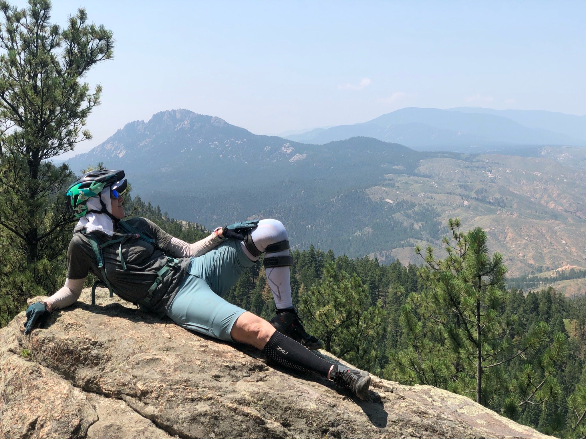
Ten-Mile section of the CT ascends 3,300 ft in 8.4 miles. It then descends 3,000 ft in 5 miles through 1.7 billion-year-old basement rocks that cover the crest as well as the valley below. As you travel along the CT on this portion of the trail, you cross under six or seven different passes and crest above the tree line for several miles of tundra riding with astounding views of the surrounding mountains below. You literally feel like you are on top of the world, surrounded by green and wildflowers and you can see for days. The riding through the tundra section wasn’t the worst, but was generally slow going at times with short technical, unrideable sections and some descent exposure (that I don’t deal well with).


Once you crest on 10-mile/Miners and head towards Wheeler, you start to descend down towards Copper Resort. We had staved off eating lunch until Copper because we wanted a proper place to sit, a cold coca-cola and any other fun munchems that the market might have. One part of the rocky descent just down from the crest got a little rowdy.
Aliza is a daredevil, and as I mentioned in a prior segment, likes to do anything she can as to not have to walk or push her bike - partly out of the condition of her knee, but I think also to do with a little with her pride. The trail was getting precariously steep and while I definitely would have ridden it with a not-fully loaded bike, with some suspension, with a dropper, I chose to get off my bike and take a look. It seemed a bit too risky to me, so I got off and started walking. But Aliza? Not to my surprise, Aliza started bumbling her way down the bumpy pathway, trying to navigate her way down without gaining too much speed and not hitting any of the human-head shaped rocks in our way. She got about a quarter of the way down when her front wheel got bumped off course and away she went like a lost cow, stampeding through the brush. I thought she was in for, but she managed to slow herself enough eventually to where she just tipped over into the brush. It was a sight to see! I had to stop hiking my bike because I was laughing so hard and was grateful that I didn’t have to pee, cause I surely would have wet myself. Needless to say, I was very satisfied with my decision to hike my bike and myself down the rest of that part of the trail.

Me, making smart decisions!
As the trail re-entered into the tree line, the descent became more rideable and more fun, flowing into a few switchbacks and more wildflowers. We were almost to the bottom when I managed to take myself out and landed on my tush off my bike. I got distracted by all the beautiful landscape and suddenly I was on the ground. I didn’t get hurt though and laughed about how ridiculous I felt for falling over on such a non-technical part of the trail.
You can see Copper Resort as you descend off the hill, but it seemed to take forever to get there. What I thought would take us just a bit of time ended up taking quite a bit longer because it was up and down and up and down. I was ready for lunch! Also, it was early afternoon and we could see the storm clouds rolling in like clock-work. It was here, on the roller coaster trail that we ran into a couple of other cyclists who were racing and going the opposite direction from us. One especially looked haggard and talked to Aliza for a bit while she waited for me to catch up. Little did I know that two years later, this guy, Mike, would become one of my good riding buddies and would ride the Kokopelli trail with me in 2023! It’s such a small world!


We arrived in Copper resort and made our way to the market just in time for it to start raining. We sat on a bench near the market and I warmed up my dehydrated refried beans for my bean burrito lunch (yay for hot lunch!) Aliza was also snacking on the smorgasbord of nom noms that she had in her pack as well as what we had picked up from the market. Our glorious lunch was brought to a halt as a raging storm blew through. Crazy hail and wind bombarded all the tourists and they scattered like sheep. We hunkered down along with a few other CT racers who had stopped for lunch and a recharge as well. They were contemplating whether and when to go back out on the trail, as they were starting to head up the mountain the other way towards 10-mile. I, personally, would not want to be up there during a thunderstorm, but some of the guys were saying they were going to risk it. All for the race, right?

Calm before the storm. CT racers had made a pitstop as well!
Aliza and I hunkered down trying to decide what to do and finally decided, after the clouds broke just a bit that we needed to make it as far as we could until the next storm system. So we bundled up in all of our warm gear, and our full tummies and started the climb up to Kokomo Pass. On our way out of the resort we ran into one other lady racer so we cheered her on with our words of awe and encouragement! The rain cleared just for a bit with only sprinkles and we were immediately too hot in all of our gear, so we had to stop and strip down. But, as nature would have it, not even 30 minutes later, it was pouring again.


We could tell that there were going to be a few storm systems rolling through, each bringing with it wind, more rain, and then ebbing just a bit before the next one, so our plan was to make it as far as we could get just below the tree line, and then call it for the day. We were wet and tired and ready to be done. On our way up, we kept looking for a site that was somewhat near water that one of our friends had mentioned on his CT trek. We even had a pin dropped where he had stayed, but when we got to that point (or what we thought was that point) there wasn’t really any where to camp, so we kept going. Finally, we found a little spot just off the trail that seemed to be a little covered by trees, which we thought might help keep things a little “dryer.” The only problem was that we weren’t near water, but we didn’t want to risk going any further up and not having a camp spot. So, we pitched the tent in the pissing rain. Aliza agreed to start some hot water if I would go on the hunt for water that was about a mile up the trail. So, I got most of the bladders so that we would have enough for the rest of the day and the next morning and went for a hike.
The hike was actually quite enjoyable. It was all uphill on the way up, but not too steep and it was absolutely beautiful in that area, overlooking meadows, a ton of trees, and even with the rain and setting sun was quite magical. I got to the water source, which was just right off the trail and easy to get to. I was just minding my own business passing the time in my own head, when guess who I would run into at the water source? Our Grumpy Curmudgeon friend from earlier that day. I said hello and at first didn’t recognize him with all his rain gear on, but as soon as he started talking, I knew his cynical voice instantly. He had a lot to say about the rain, and then asked if I knew if there was an open campsite ahead and that “there better be an open site because he’d walked all this way and wasn’t going to go over the *#$% pass tonight…” and other grumblings of the sort. If any of you have ever read Bill Bryson’s book, “A Walk in the Woods” about his Appalachian Trail experience, you could probably imagine that this person is similar to Bill’s friend that accompanied him on the majority of the trail. If you haven’t read it, you should - it’s a great read. Anyway, he trudged on and left me in peace and I hurried my way back to our camp and arrived just at dusk.
We huddled and cooked our food quickly…in fact, I’m not even sure if I ate a hot dinner that night because we had had lunch so late. Either way, our bed time could not come early enough. We planned to wake up before light the next morning and ride in the dark up the hill so that we could most assuredly get over the pass before the thunderstorms hit, which proved to be a very very smart move on our part.
PS: No matter how much I try to remember to get pictures of the grumpy/no good/rainy and cold parts of the trip, I always forget. So, pretty much we had no pictures of our trek after our rainy lunch at Copper Mt Resort. I’m sure you can use your imagination though.

Bikepacking the Colorado Trail: Part 2
Day 2: Buffalo Creek CG to Twin Eagle CG
Stats: 43.3 mi, Elevation Gain: 5033ft, Moving time: 5h41m, Elapsed Time: 8h38m

We woke early and knew we had a pretty warm day ahead of us. I don’t remember much about this day except that I felt pretty good and Aliza didn’t. At Rolling Creek TH, the Lost Creek wilderness detour began, which meant we were on mostly paved/dirt roads for the day. You might think that sounds wonderful compared to trails, but in this case it also means sandy, non-graded roads, open treeless passages (hot), and washboard.
For me, though, with my hardtail, compared to Aliza’s full suspension trail bike, it was quite plush. My energy pedaling helped propel me forward right up the hill, where Aliza’s bike sucked a lot of energy that she was putting in. That, plus her sensitivity to heat made for a long grueling day. We rode together quite a bit, but also we rode with the understanding that we each just go at our own pace up the long ascents and then meet at turns or occasionally on the hills, just to make sure we don’t get too far apart. Eventually I realized that Aliza really was struggling and she needed more of a rest than just a quick stretch and a snack.


We stopped in some of the only shade we could find on the dirt road in the middle of the day. Ants ate our legs alive in the first couple of spots we tried, but eventually, after naming the road Ant Hill, we found a place to stretch our legs. We stripped down, doused ourselves with water, ate some snack-ums and just rested for a while. At this point we were in the heat of the day and we knew we just needed to not be in a rush and take it easy or else we could possibly get too overheated.

The road climb to the campsite was beautiful and brutal at the same time. We were literally only a few miles from camp when Aliza had to just not pedal any more. We dismounted, clamored over to a shaded rock area and laid on the cool rocks for about thirty minutes or so. We had just a bit of climbing left, so after a pep talk and some grumbling, we were on our way. We pulled into the campsites near Tarryall Reservoir and it was a busy, crowded mess. It didn’t look like there were many, if any, open spots, so we looked at the map and saw there was a smaller camp ground that we could possibly find a spot at. This was a good call! I think we ended up at Twin Eagles CG, a small spot, with maybe eight camp sites. We plopped in the first one we came to and set up camp. We arrived at about 3:30pm so we had plenty of time to rinse off and cool down in the lazy river right next to our campsite. After living and bikepacking in AZ, I will NEVER take a stream/river for granted! It is such a luxury to be ale to have an after-ride “bath” and a “wash room” for our salty, dirt-filled clothes.


Day 3: Twin Eagle CG to Jefferson Creek CG
Stats: 35.09 miles, Elevation Gain: +3802, Moving Time: 4h 55m, Elapsed Time: 8h24m

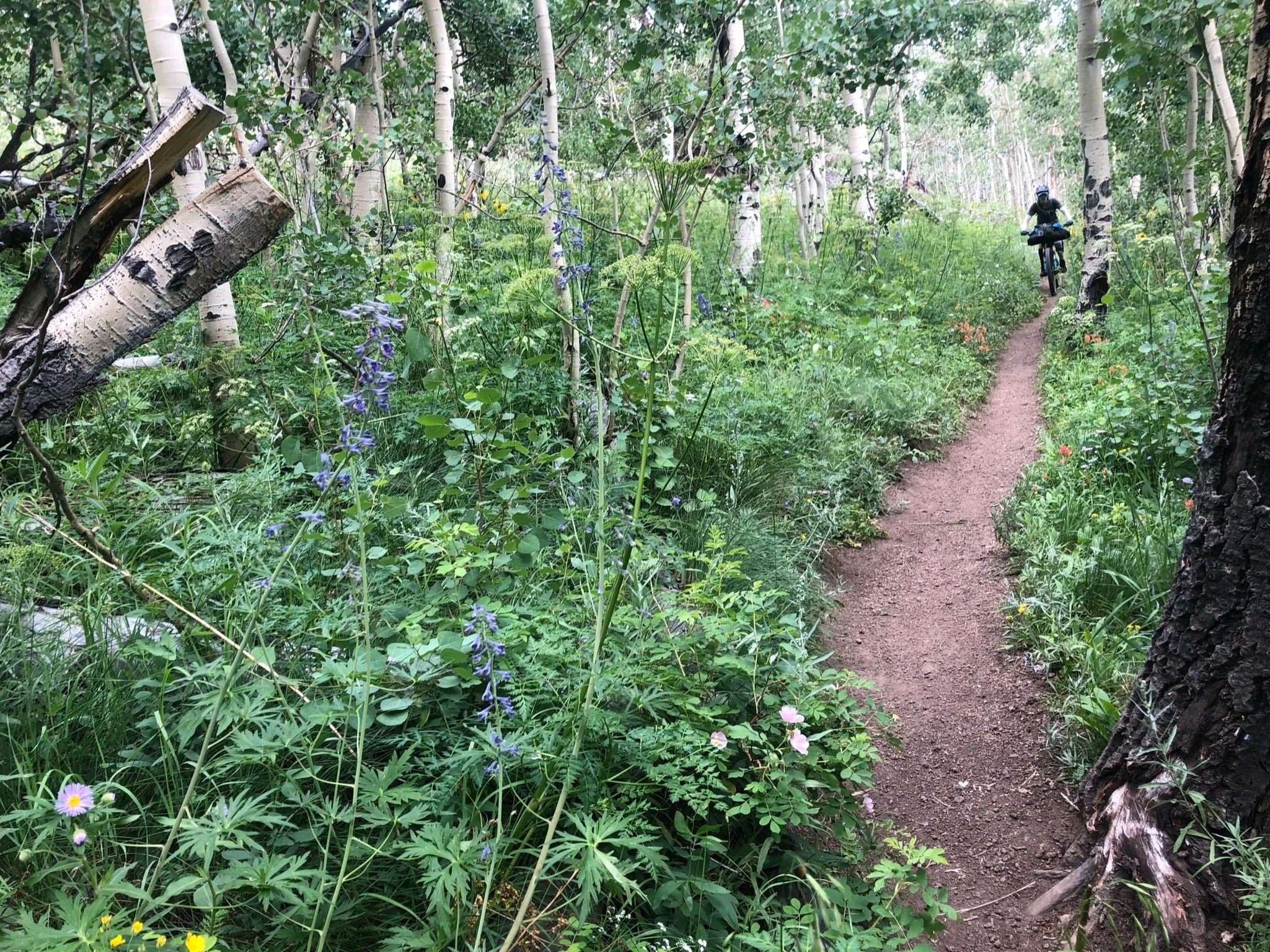
We woke up, refreshed and thankful for a cool morning. We tried to get an early start and were on the road by 7am, which all things considered with having to pack up and make breakfast and all that stuff, was a pretty great feat. We would be leaving the wilderness detour and rejoining the CT proper, which we were pretty excited about. The morning was pretty uneventful, and I thought it was pleasant, as we motored up to high alpine through the aspens, enjoying the rideable singletrack. The only drawback of getting such an early start was that we tried to stop by the well-known Lodge but it was closed when we got there. They have variable hours and we knew it probably wouldn’t be open bevcause it was early. We stopped for a quick snack and were on our way.


After gravel and aspens and wildflowers, our lunch stop was at Johnson Gulch where there was a cute little stream, and I swear we had turned into Bilbo Baggins and Frodo and had been galavanting in the Shire. Though it was a little buggy, the creekside resting place was much needed and our lunch spot gave us the energy we needed to continue on. We ran into two guys on foot (I think?) that had stopped for lunch as well and had a wee chat before they went one way and we went the other. Lunch legs hit hard when we realized we had to climb out of the gulch we were in and the long afternoon slog proved mentally (and physically) challenging.

Lunch break and stretch at Johnson Gulch
The climb up to Kenosha Pass was a bit brutal. I have pretty much blocked it from my mind. The only thing that I do recall was that, except for the two hikers in the gulch, we hadn’t seen anyone for the entire day and were just mentioning how it was something special to be able to ride to a place in the middle of nowhere that was inaccessible by anyone unless they really put the effort in when two people on horseback and their pup rounded the corner. We chatted for a bit, reveling in the beauty of where we were at on that ridgeline with views for miles and the serenity of it all. We bade each other adieu and continued toward the top. The camp area near the summit had a pump water station, so we filled our bottles, doused our heads, cleaned off a bit with our handkerchiefs readied ourselves for the final roll to Jefferson Creek CG.


At one point, we heard some noises in the trees and stopped quickly, unsure of what we would find. Suddenly, a few large quail flew out in front of us and we jumped so high! We giggled afterwards, and saw a whole family of the birds, climbing onto one of the branches that lay on the ground. They gave us quite the scare, and we were glad it wasn’t anything bigger.


Towards the end of the day, clouds blew in and started spattering sprinkles on our tired legs, shortly before we reached camp. We got a little turned around, unsure of which way the trail led to the camp vs. going through on the trail, but eventually found our way to the camp site in the late evening. We hadn’t known exactly where we would meet Patty Sag, whether it be on the road or at the campsite, but eventually we saw the van pulling into the camp just in time for dinner and just in time to get warm for the night. Aliza got a comfy bed in the camp and Patty and I slept in the tent. We dove into our resupply boxes for special treats that we had sent ahead and slipped into our dry, fresh clothing.


Bikepacking the Colorado Trail: Part 1
The Colorado Trail is a 468-567 mile through-trail that runs East-West from Denver to Durango. The CT was originally completed in 1987 after Gudy Gaskill founded the Colorado Trail Foundation in 1986 with the main mission of the organization was to compete and maintain the trail. The trail in its entirety is kept up by the continued work of the Colorado Trail foundation, which is volunteer led. Work on the trail is mostly done by the organization who work in cooperation with the US Forest Service. As you might imagine, keeping up over 400 miles of trail is a daunting task so the efforts of these volunteers is a fundamental part of the trail's continued existence and use. After experiencing the beauty and epicness of the CT, it is astounding to me that such a large stretch of trail has been kept in such great condition over so many years. Thank you to all those out there who provide their time and energy and money to help keep this trail in existence!

Aliza at Lenny’s Rest
Bikepacking the trail is quite a feat. People have been traveling the trail on foot for years, but only in recent years has bikepacking the trail as a through-ride become more popular. It has been said by many bikepackers that have attempted the CT that it is a hiking trail that you can ride your bike on. I can readily confirm that is the case. With a ratio of probably 60/40% ride time to hike-a-bike time (of course depending upon your fitness level and technical riding ability), the CT is no joke, especially if you ride self-supported with all your gear that you would need for anywhere from four days to a few weeks. The Colorado Trail Race is a bikepacking self-supported race that takes place every summer with a grand departure in late July, alternating years going East to West or West To East. The race’s inaugural year was 2007, starting in Denver and heading West towards Durango. The race, at the time, had only three rules:
Race from Durango to Denver, self-supported, under only your own power, along the entire CTR route
No pre-arranged support, with the exception of mail-drops to a post office and only a post office
Don’t break the law
There may be a few more rules at this point, but overall, you get the gist. There are no prizes, no finish line glory. Just the bragging rights to say that you completed the trail in the fastest time that year, and of course, peeps are always vying for the FKT. Though I commend these folks for racing the CT, I honestly don’t know how they do it. I felt like I was at my max most of the time and it took us 14 days to complete (most) of the trail. I am amazed, especially by the chicas, like Alexandera Houchin, who completed the course in 6 days, 2 hours, and 33 min in 2022! Yes girl!

Me. In a lot of pain from separated shoulder. Eating Icecream, cause why not?
When my bestie, Aliza, and I decided to ride (not race) the CT, we knew it would take probably about 2 weeks (at least), so we put it on the calendar…in 2020. Well, as we all know, COVID had other ideas. I also separated my shoulder during a fun ride up in Oregon a couple of months before our scheduled trip. A few weeks before our scheduled departure, we knew it wasn’t meant to be and we tabled the ride until 2021.
The next year rolled around and everything fell into place. The weather was looking good, snow levels were perfect, and we both got the time off of work. Better yet, my boyfriend Patrick (Patty, aka Patty Sag), offered to be a SAG wagon for us and drive Aliza’s van to meet us every few days, so that we didn’t have to ship anything or worry about resupply. This was great news, especially since Aliza deals with quite a few dairy restrictions, so it meant she would be comfortable the entire trip and not have to worry about resupply at small markets and things like that.
Aliza and I are both experienced adventurists. We have ridden significant portions of the Great Divide MTB Route, Baja Divide, completed the entire Oregon Timber Trail, Kokopelli Trail and other smaller multi-day Type-2- Fun adventures, so we felt like the CT was the next level up. This would be the first trip that we would have to plan away from each other because I had moved to Phoenix in 2019 and she was still in Portland, but after many FaceTime calls and emails, we managed to pull our trusty spreadsheet together. Our spreadsheets looks something like you see below. We each can edit it at leisure and it gives both of us a good opportunity to familiarize ourselves with the trail, what to expect, etc. We both had a copy of the Colorado Trail guidebook, which you can purchase here. We also include things like links to lodging, confirmation numbers, phone numbers, etc and make sure to share the document with our loved ones and close friends so they can keep tabs on us and make sure we are safe!

Our nifty little spreadsheet!
The plan was to meet each other in Durango; Patty and I drove up from Phoenix together and Aliza drove from Portland in her van. We were lucky enough to be hosted by a friend’s friend’s mom and step-dad in Durango. Joan and John were the best hosts! They whipped up some popcorn for our arrival, made sure we had plenty of snacks and beverages and had a garage in which we could store bikes and gear. Best yet, their place was even right next to a trail head so we could go spin our legs out!


Getting acclimated in Durango for a couple of days was helpful - even though it was a couple of days, it gave us both a chance to feel crappy on the bike before heading out on the CT. We loaded up our bikes with our gear to make sure everything was working correctly and went out for a spin. It was rough! I felt like I couldn’t ride my bike, couldn’t catch my breath, and wasn’t having a ton of fun. It made me rather nervous, considering I was going to have to do a lot more riding up crap-ton more elevation and with a lot more weight on my bike, but just tried to brush it off, knowing that the altitude had a lot to do with how I was feeling and that it would get better with time.
Our ride the second day took us from the house. I can’t remember which trails we rode, but it was basically, climb, climb, climb, and then descend down some pretty fun technical/switchback descents. In proper Colorado fashion, it started raining just as we finished our descent. By the time we got about two miles from the house, it was pouring rain, and we huddled under a large tree, contemplating whether it would pass quickly or if we should just dash home and get soaked. We chose the latter, and sprinted toward the house. We showed up looking like the three drowned mice. I figured we’d just need to get used to it because we’d definitely have to deal with the thunderstorms on the trail.


The morning of our departure, Joan whipped us up a delicious frittata and sent us on our way with coffees in hand. The drive to Denver seemed to take forever. We got to town just in time to swing by the REI and grab some last minute items/foods and then ate dinner. We were originally planning on camping somewhere near the trailhead, but since it had been raining that day, I contacted my friend Will and he graciously invited us over to stay with him and his girlfriend for the night. We’d be leaving early in the morning so this was perfect so we didn’t have to worry about taking down camp before we rolled out.
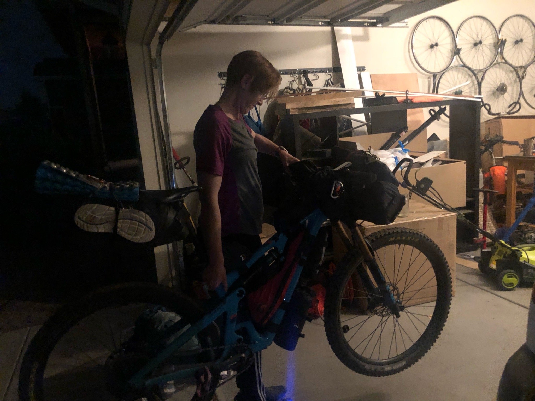
At Will’s house, we unpacked our crammed bikes and gear and outfitted everything up so we wouldn’t have to worry about it in the morning. I was glad we did because as I pulled out my bike, I noticed that the rear tire was completely flat. Ugh! There was a huge sidewall gash, which must have happened when we were stuffing all of our gear and three bikes into the back of Aliza’s van. Luckily, because it was way too late to try to hit up a bike shop, Will had a brand new tire that I bought from him and we got it squared away with not too much hassle. (Thanks Will)! Will was a peach and put up with us nervous chatty Kathy’s. He has completed the CT race a couple (few?) times prior to that year, so knew what we were in for. He regaled us with his stories of terror and awesomeness of his experiences - I don’t know if it helped or made us more nervous, but it was still exciting to hear about some of the places that we would soon see with our own eyes.
The next morning came all too quickly, and as I rose to pack up and roll out, I realized I was not quite ready to be missing the comfort of a shower and bed and my tummy was a little nervous. I couldn't eat breakfast, but figured I’d get something down once we started riding. The trail terminus was about a 30 minutes drive and it went fairly quickly, especially so early in the morning. We unloaded our bikes and made sure we had everything. Obligatory picture time was had, and away we went!


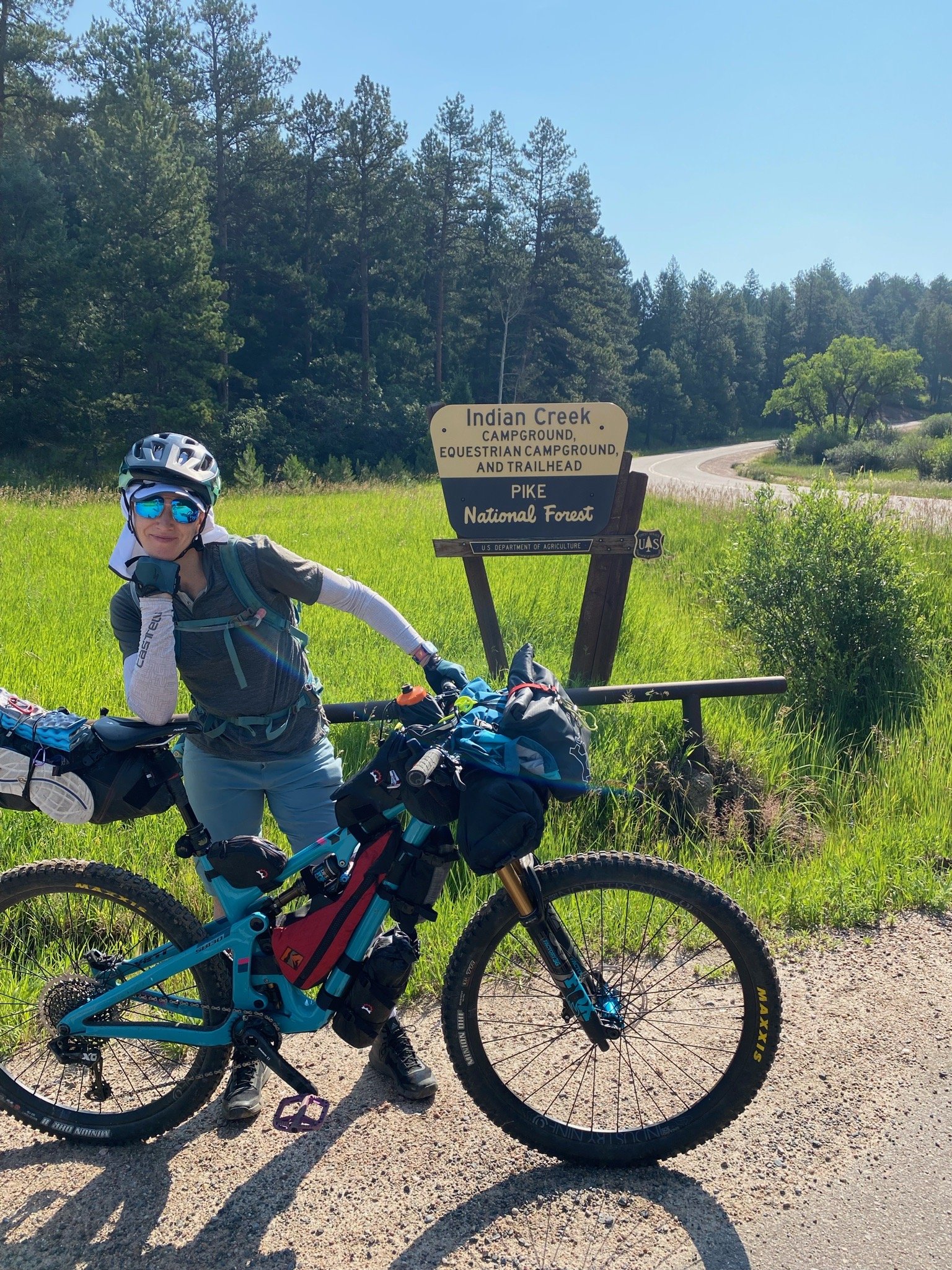
Day 1: Indian Creek TH (East Terminus) to Buffalo CG
Stats: 31.6 miles, +4695 ft, Moving Time: 5h49m, Elapsed: 9h03m
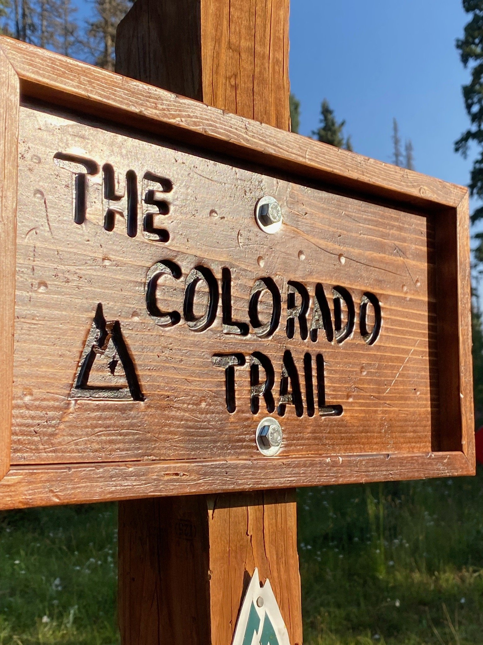
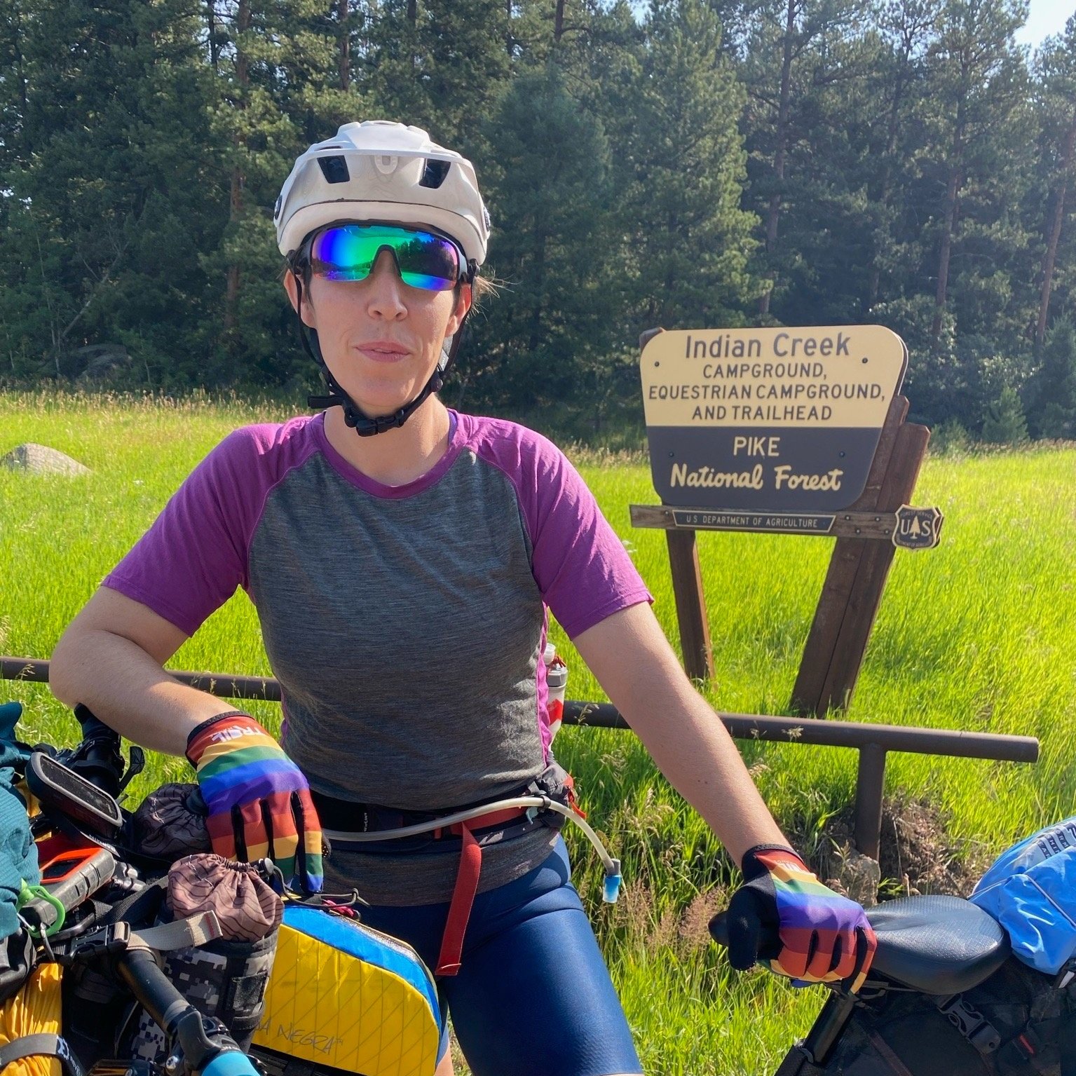
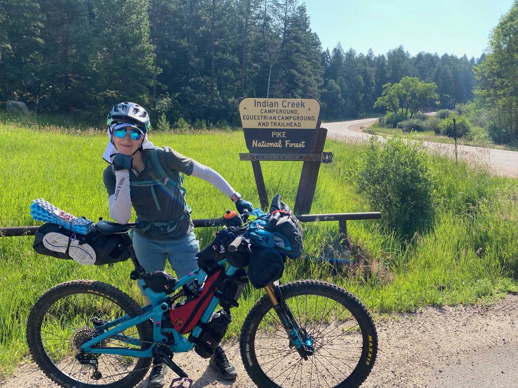
We arrived at the Indian Creek Trailhead at around 7:00 am on July 26, ready to ride. It was a clear, cool morning, which was perfect for the start of our radical adventure! Feeling some nerves and jitters, we double and triple checked that we had everything we needed. Picture time was had, and off Aliza and I went, leaving Patty Sag behind. We would see each other in a few days.

Rolling out on the CT!
The trail from Indian Creek TH was lush and somewhat overgrown but it was a short, fun descent. We quickly got our “trail eyes” on and then realized, but as soon as we reached the bottom, we realized we would have to climb out of the valley that we just descended into. We reached the famous bench at Lenny’s Rest by about 9:15am and took a brief reprieve. We were officially on the Colorado Trail.


The hike-a-bike began early in the day and it was no joke. Aliza was on her last leg (literally) with her knee. She has since had a total knee replacement, but at the time, the hiking with her bike was not kind to her. She had really been working hard with her physical therapist and on her own to get ready for the trip, plus her brace helped her stability, so she was doing the best she could, but we both knew that her knee, which she aptly named “Hermio-knee” would be the weakest link on this trip. I was still dealing with stability and strength issues from my previously separated shoulder, and hoped it would hold up. I only felt it give a couple of times up the hill, so figured I would be able to make it the rest of the way.


We made our way up the bush-lined trail, which seemed to never end. Through-hikers that we had passed earlier in the trail leap-frogged with us the rest of the way up, making me question why we were hoisting 70 lbs of bike up this trail, though once the descent began, it made me gloriously excited to be on two wheels!
I honestly can’t remember much about the trail between the hike-a-bike section and the exposed burn area toward the end of our day. I know it was hot, which Aliza really struggled with. My training in AZ helped me acclimate pretty well, which I was grateful for (cause it was still a difficult ride). After a flowy descent, we started climbing again into a vast clear cut area that is recovering from the Hayman Fire of 2002. The openness of the landscape was unreal to ride through and was a complete change from the lush greenery and towering trees that we had just exited. Here, we were exposed to the elements including the heat and the wind, which were relentless. On top of that, the dirt was quite loose, so any time it pitched, our tires would slip out, causing us to dismount and hike our bikes. Aliza killed it in this section and I suffered hardcore. Even though she suffered from the heat, her strength and mental determination to not have to hike her bike more than she absolutely had to helped her get up those steep pitches. We eventually got through the burn area and made our way up to the unmanned fire station where there was a water spigot. It was time for a break!


We hadn’t seen anyone else on the trail for quite a while. We began to record our daily trail report when lo and behold, a young man came out from behind the station to say hello. This through-hiker had been taking a siesta in the shade to avoid the heat of the day and was about to get on his way. It was fun to talk to someone about the trail for a bit. We had found a “trail angel” Coca-Cola on the bench near the station and we told him he should have it since we would probably be able to reach someone/somewhere with a cold Coke well before him, since we were on bikes. After snacking and chatting a bit, we were on our way since we had a ways to go until our stopping point for the night.
We arrived at Buffalo Creek CG early in the evening. I think there was water for us to rinse off, but I can’t quite remember. We set up camp early in the evening and laid down for an early night, as would be the case for pretty much the entire trip. This is one of my favorite things about backcountry adventuring. There is something fulfilling about the simplicity of working hard all day, being with yourself in nature, sleeping and waking with the sunrise and sunsets and only having to worry about moving forward, keeping your body fueled, and your mind strong.
