Bikepacking the Colorado Trail: Part 5
Day 9: Shavano CG to just past Marshall Pass TH
Stats: 13.39mi Elevation Gain: 3806ft, Moving time: 3h58m, Elapsed time: 6h25m

The morning was dry but still cloudy. The ground was still wet, but we took the time to set out all of our wet gear to try to dry some things out while we ate breakfast, sipped our steaming coffee and packed. Our goal for the day was to try to get up and across Marshall Pass by the thunderstorms and then just get as far as we could, which didn’t turn out to be very far… haha Though, elevation-wise 3.8k ft in 13 miles is a pretty big feat.


So, the day started out alright, but before too long, the rain began. We began the climb up towards Fooses TH that would lead us to the top of Monarch Crest and over to Marshall Pass. I was pleasantly surprised with the climb up towards Foose’s. Aliza was not. Her legs weren’t having it, and it turned out that she was also very distracted mentally because she was going through some relationship stuff which had come to a head while she was out on the trail. So, needless to say, with her brain energy going elsewhere, she didn’t have much grit left to help push her along the relentless ascending landscape.


We arrived at the Fooses trailhead and saw her van parked. We got pretty excited because we were thinking that maybe we could get some dry socks and clothes, but alas, it was all locked up and Patty was nowhere to be seen. We knew he was out riding that morning, but didn’t know where he was at the time, so we decided not to wait for him since we needed to keep climbing to avoid any worse weather. So much of the trail was rideable, much more than I had thought, which put my spirits in top gear and propelled me forward. I kept pulling ahead a bit and then waiting for my buddy to make sure she was alright and still moving forward.
Up the trail I saw/heard some MTB brakes coming towards us and out of the forest appeared Patty and his friend Chris, who had joined him for some rainy riding. They had ridden up Foose’s Creek access road, which connected to Monarch Crest, took that over and went down Foose’s creek. So, they got to experience the epic climb going the opposite way. After experiencing the up way, I don’t know which I would have rather done. Either way is epically steep and rocky.
Anyway, we chatted for just a bit, they were just as soggy as we were. Aliza finally joined with a not so happy countenance, said hello, and then we kept trudging upwards. I was under the impression that we had done most of the climbing and I was ecstatic that I had ridden so much so far. Little did I know that the worst was yet to come.
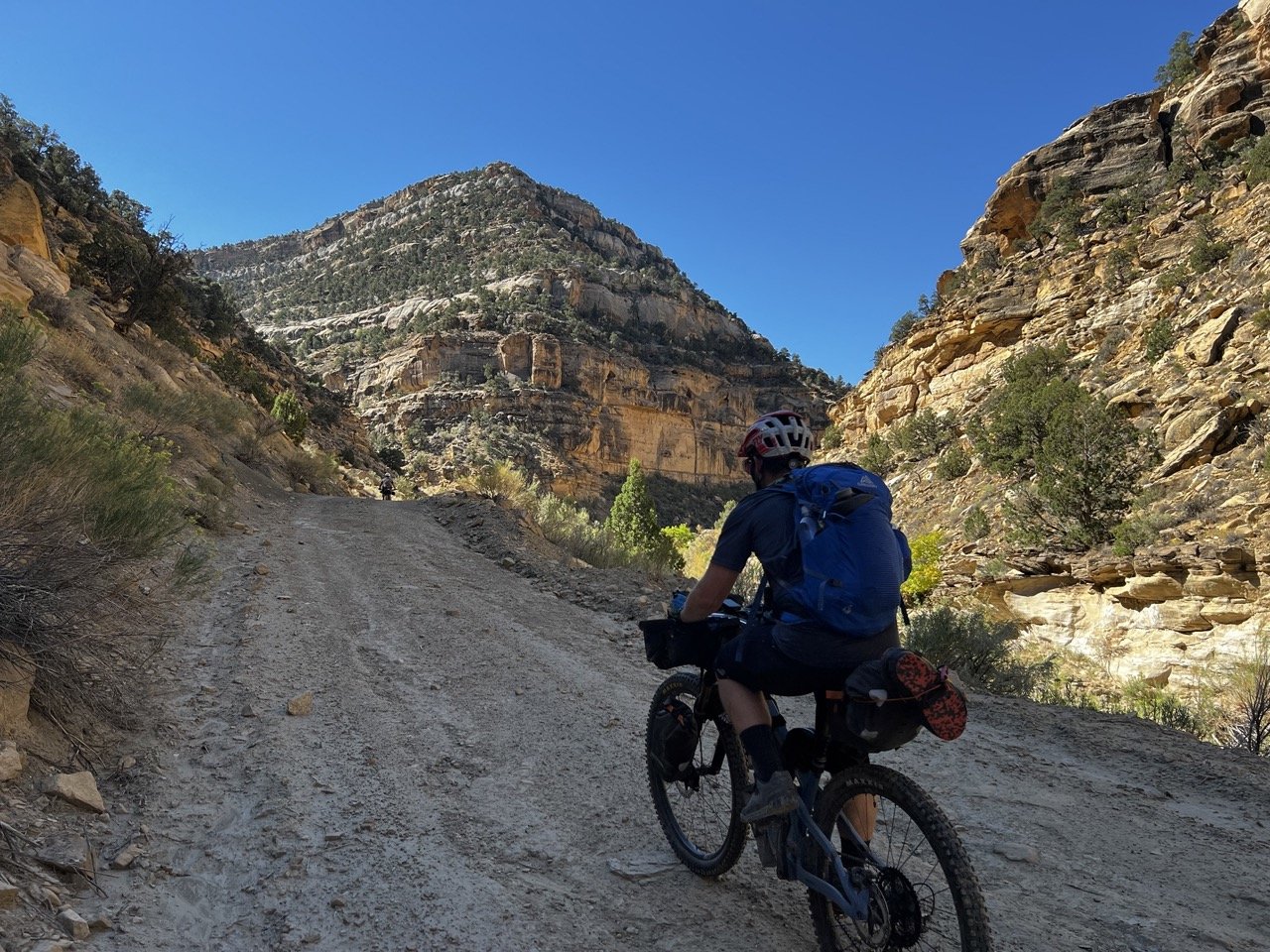
From then on out, the trail just got steeper and more rocky. Here was the part that everyone talked about. My mental party came to a halt when I realized that this was serious business. I just needed my shoulder to hold out through all the pushing and carrying my bike and we needed to get to the top before the big storm that was rolling in. Our mentality from here on out was just to get up to the top at our own pace. I made sure to check on Aliza, especially on any of the especially steep spots where you had to hoist your bike or shove your bike inch by inch up the hill. Her knee was very tired/painful and she was not in a good head space.
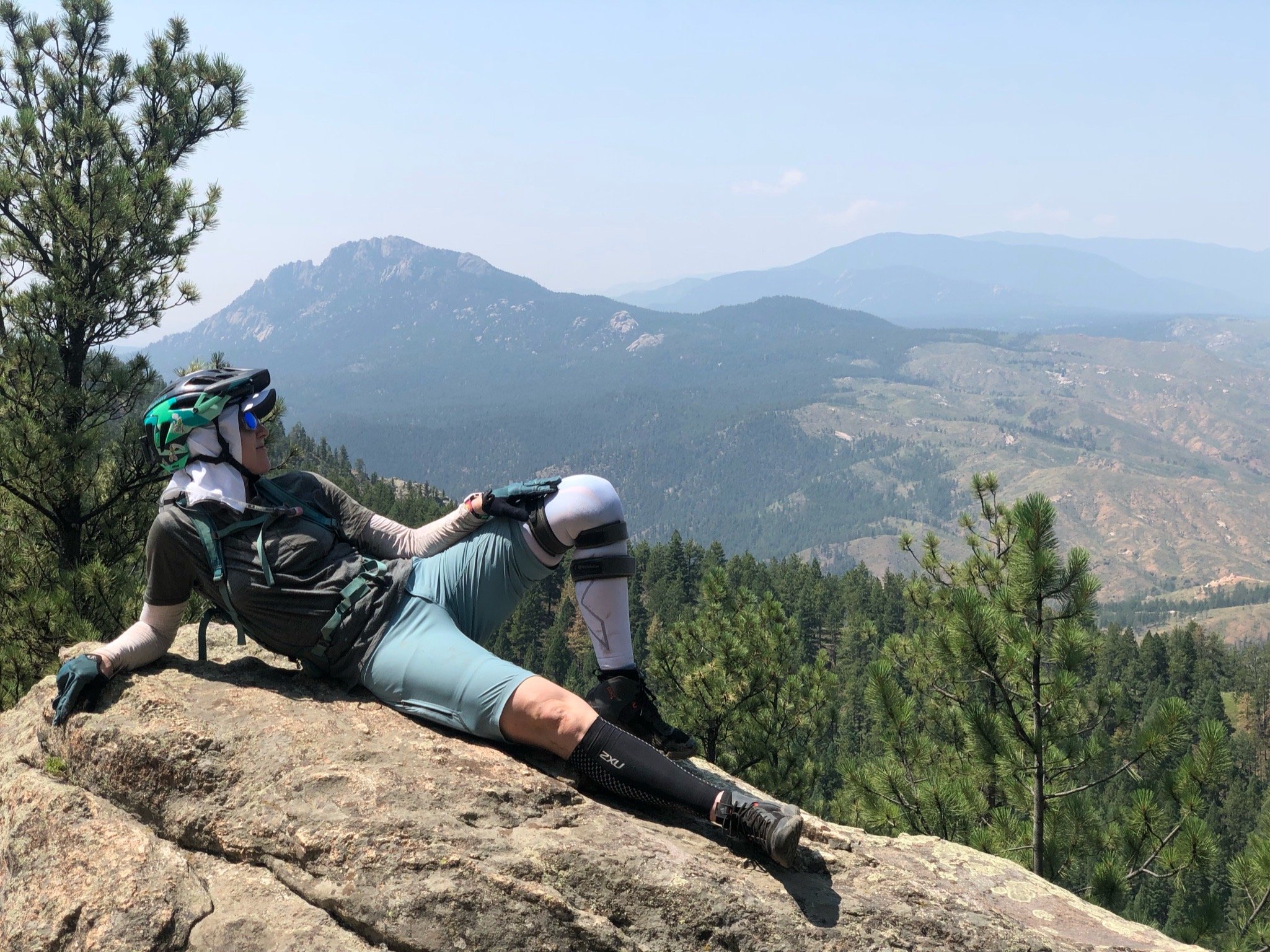
Eventually after hours of pushing/hauling, I crested the very top of Monarch Crest. I thought I almost wasn’t going to be able to push my bike fully-loaded by myself up the last stretch. To say steep was an understatement. It was, by far, the steepest section of trail we had to hike up. Aliza was a ways back so I ditched my bike after a quick breather and hiked back down to help. She graciously accepted and we inched our way up to the top, her pushing from the front and me following from behind. The relief from being at the top quickly overrun by the urgency to get down off the mountain. We could see the darkness creeping in and it was freezing at the top. We managed a quick snack, a few pictures and tried to enjoy the view and kept pushing on.


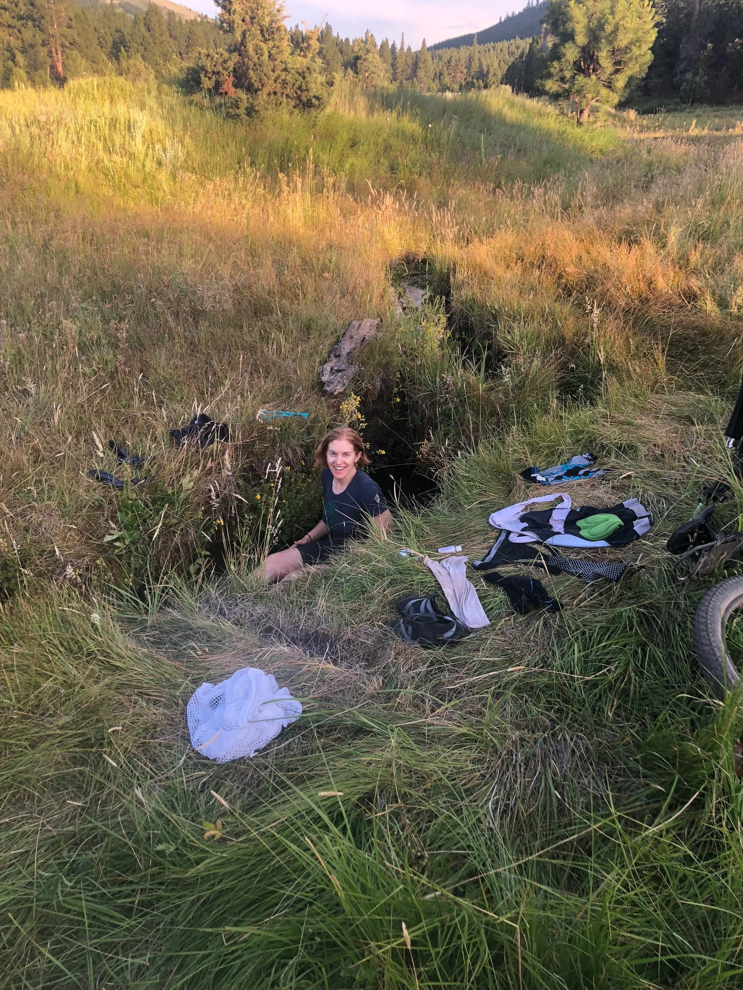
Once you crest, you get to traverse the ridge and head generally downhill towards Marshall Pass and the jeep road. This section would have been fun had we not been in a hurry and not been freezing cold. The wind was whipping around us, and the rain which had started to sprinkle was feeling more like a sleet on our faces. We made it to the road without any major incidents and sat on the side of the road deciding what we wanted to do next. As we ate lunch, suddenly there was a boom of thunder and a torrential downpour began complete with wind, sleet, lightning, etc. We had missed the storm by just minutes and were glad we weren’t hadn’t spent any more time at the crest. Aliza decided that it would be best for her to call it for a while. We agreed to set up the tent and sleep/chill for a bit to see if the rain would dissipate after a few hours.
This is when the already blowing/raining chaos that was already happening got even worse. We were trying to find a spot right off the road to set up the tent. We found a bit of “dryer” ground under some trees right down from the roadside, though it was covered with cowpies. We scouted around and finally found a small space that we thought would suffice for our tent. So, now, to get the full picture - we are trying to set up a tent in a monsoon, sleeting, hailing, full wind, trying to avoid cowpies, sopping wet with freezing hands, and trying to do so as quickly as possible. We got the tent set out on the footprint, but then quickly realized that rain was getting inside the body of the tent because it was netted and the rainfly wasn’t on. We just figured that we’d hurry, but then as we were trying to get the poles out, one of the pole parts unlodged from the middle part, and looked like it broke off. AFter a bit of scrambling, we got the poles together again, and started fitting it to the tent when it came apart again. It was then, that we realized, thankfully that it wasn’t broken, but it had come unscrewed at the center joint. ONce that was fixed, the rest went quickly, but not before Aliza managed to lodge her entire foot into a thick and juicy cowpie. Ugh! I felt so bad for her! What else could go wrong!
As soon as we got the tent up, Aliza got in the tent, gear and all and got in her sleeping bag to warm up. I managed to get into some warm clothing and got in my bag as well and we sat in silence, I think somewhat in shock and somewhat just relieved that we weren’t in the rain and the cold any more. ALiza had been smart and brought hand warmers, so she shared one with me, which was a life saver.
She fell asleep instantly and I sat there wondering what I was going to do for the time being. It was still early in the day and I didn’t know whether to change my clothes to night time clothes or to make dinner or lunch or just try to fall asleep. I felt a bit claustrophobic: too cold and wet to go outside, but too restless to be sitting in a tent for the next however many hours. Eventually I dozed for a bit once I got warm, and then woke up very hungry. Now, I know that it is against the rules to eat or have food in your tent, but we agreed that this was a dire situation. After Aliza woke up I stressed to her that she needed to eat something, even though she didn’t want to, so we grabbed our goodies and made up some hot meal, keeping our food and fuel in the vestibule. We both kept our heated dehydrated meal packs in our sleeping bag as we waited for it to “cook” and I don’t think I’ve ever been so warm in such a dreary situation.

The rain didn’t let up and Aliza couldn’t bear to think of getting out of the warm, dry-ish tent to continue any further, so that was that. We slept on and off, eating when needed, only to get out of the tent to take care of business and put away food, and that was the rest of the day. We did “see” or rather hear one through-hiker that was actually hiking the CDT. We talked to him a bit through the walls of the tent. He mentioned that he had heard rumors of moose sightings right where we were camped. We hadn’t seen any, and hoped that they would just leave us alone if they came through when we were in the tent. The gentleman went on his way, I don’t know who he was or even what he looked like - but I hope he had a good rest of his rainy day hike! I think we were asleep before dark and slept through the night until morning.

Are we there yet?
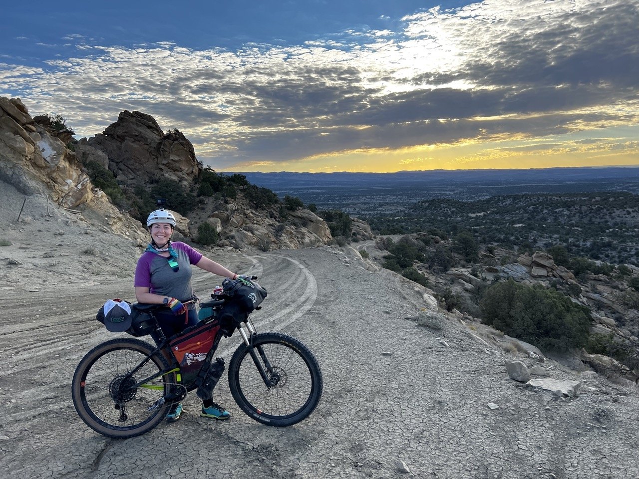
Day 10: Marshall Pass to Razor Cr Trail/Lujan Creek
Stats: 21.5mi, Elevation Gain: 3829 ft, Moving Time: 5h50m, Elapsed Time: 9h22m

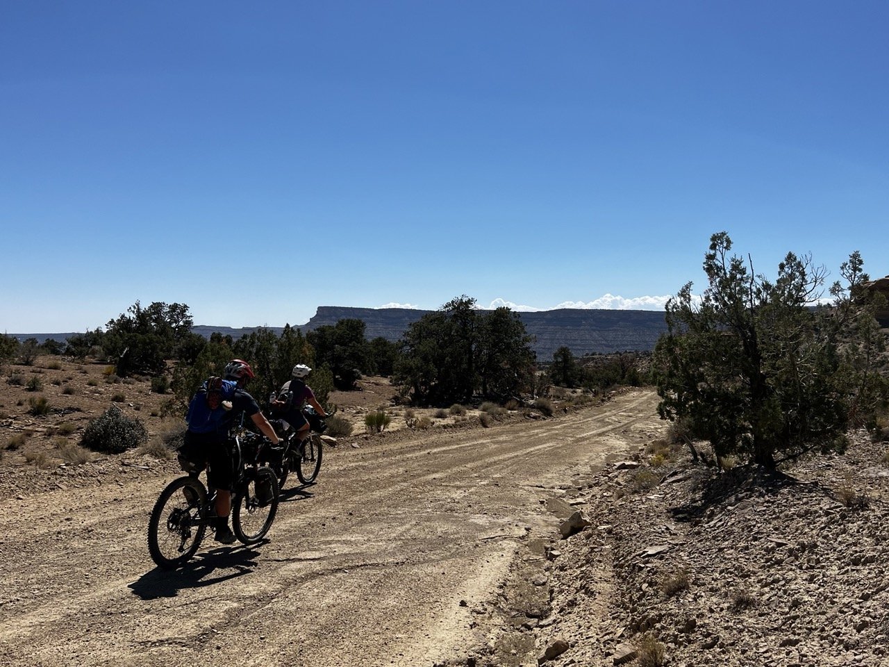
We woke up to glorious sun beams shooting rays through the clouds! It’s truly amazing what a little vitamin D does for the soul. Also, we had slept for probably 10 hours the night before so we were up and ready. We sprawled everything out in the meadow area to try to dry things out. We took a somewhat leisurely morning, trying to let things air out, and eventually we were on our way. Most of the next section of the CT is open to motorized traffic and eventually we would run into quite a few motos that we had to contend with. The beginning of the day went fairly quickly, open road, good weather and we made good time.


This was, until we ran into we ran into unrideable, deep, thick, peanutbutter puddles of mud. There was actually a small group of people doing trail work on the area and said that after they got done with the work, it would be mostly rideable. They were fixing the drainage on the trail so the puddling woudln’t happen. It was obvious that the moisture had just wrecked the trail so it was great to see that they were in the process of rehabilitating it. We said our thanks and proceeded to choose between whether we wanted to slosh our feet in the puddles or risk falling over on our bikes. A little of both happened as we made our way through to the other side.


From what I remember, the climb up Sargants Mesa wasn’t horrible. The trail was pretty smooth with occasional roots or rocks and the grade was more bearable. But not so horrible dissolved quickly as we navigated baby head sized rocks on a consistent false-flat ascent. Aliza’s patience for such terrain was short and she started cussing/walking quite a while before I did, which was surprising because she had the full suspension bike. Thai said, after a while, though a lot of the trail was “rideable” my butt finally got fed up and I just lost my mind a bit and had to get off my bike and walk. I just couldn’t even deal any more. You just really start to feel like all of your energy is sucked out by each baby head that your tire rolls over or bumps into. That, combined with the fact that I was on a hardtail just started to add up until I couldn’t take it any more and walking was had for a while until I could gather my wits again.


The descent from Sargents Mesa was no better. It’s always a disappointing thing when you get excited about descending because you should be able to go way faster with way less energy expenditure than all other parts of the trail, but the trail had other things in mind for us.
We came to see that instead of glorious descent as we had hoped, the trail funneled us into an un-rideable very rocky, rooty, jumble of boulders and washed away crevices of a trail, which was shared by motos. We approached a steep descent part of the trail to find a couple on motos heading the same way we were. They ended up passing us, which we were thankful for, but then we caught up to them eventually as they tried to push/navigate their machines down the narrow, steep “trail.” We waited for quit a while as they hefted and rolled and gunned their motors, slowly making progress. Finally, they let us pass. Even though we weren’t really riding the boulders, our bikes were a lot more manageable than theirs and we eventually made our way down the hill.
Our plan was to make it to Razor Creek, where we hoped there would be water somewhere near a place that we could camp.
We had run into a few people who had mentioned that there was an amazing view point that we could see if we left the trail just a bit and rode a few miles and then back. By the time we got to the turn off it was getting late so we coudln’t be bothered. Aliza was struggling again both mentally and physically and I did my best to be moral support and understanding but also had to give a bit of a pep talk to get her through the afternoon. We crested over the high point of the day and followed the Continental Divide for a short portion before descending towards Razor Creek. There were a smattering of tents at the top of the descent near Razor Creek and we started to worry a bit about the water situation because we didn’t see much as the creek trickled down the hill, disappearing into the moss and dead logs.


We finally found a place that seemed to have a bit of water and would be large enough space for our tent. Aliza started putting up the tent and I went to scout water. The water was only a trickle, but about 300 yards from camp I found a spot where it pooled. I dug a little bit into the mud and created a larger pool, waited for the sediment to dissipate and then used my mug to put water into the filter. It took quite a while, but worked in a pinch! The rain actually wasn’t so bad as we cooked our dinner and settled in for the night.

Bikepacking the Colorado Trail: Part 4
Day 6: Just below Searle Pass to Leadville
Stats: 28.95, Elevation Gain: 3,238ft, Moving time: 4h51m, Elapsed Time: 9h03m

We were on the trail at 4:50am, soggy as could be with almost all of our layers on. I’ll tell you what: one of my least favorite things about adventuring in weather is putting on wet shoes. I can handle most things, but wet shoes in the morning makes me grumpy. But so does having to wake up at 3:00am, so either way, it wasn’t going to be the best morning for me. The rain had ceased at some point in the night but everything was dripping and damp. We still had a bit to go before the tree line so riding through large wet roots was a thing. My headlamp wasn’t in a spot that I could really see over my baggage on the front of my bike so I was having a heck of a time.
Also, we had chosen not to eat breakfast, but just have a snack/munch as we rode and have a proper breakfast with coffee later. So, here I am, no good lighting, no breakfast, no coffee, 3am wake up call and wet cold shoes. How do you think things went? Aliza kept on trucking, which was great because it forced me to keep doing the same, even if I was crying just a wee bit. (Shhhh… don’t tell her). Finally I stopped and had a snack, which put a little fire under my tushy and I rode/hiked my bike a little faster to catch up with Aliza.


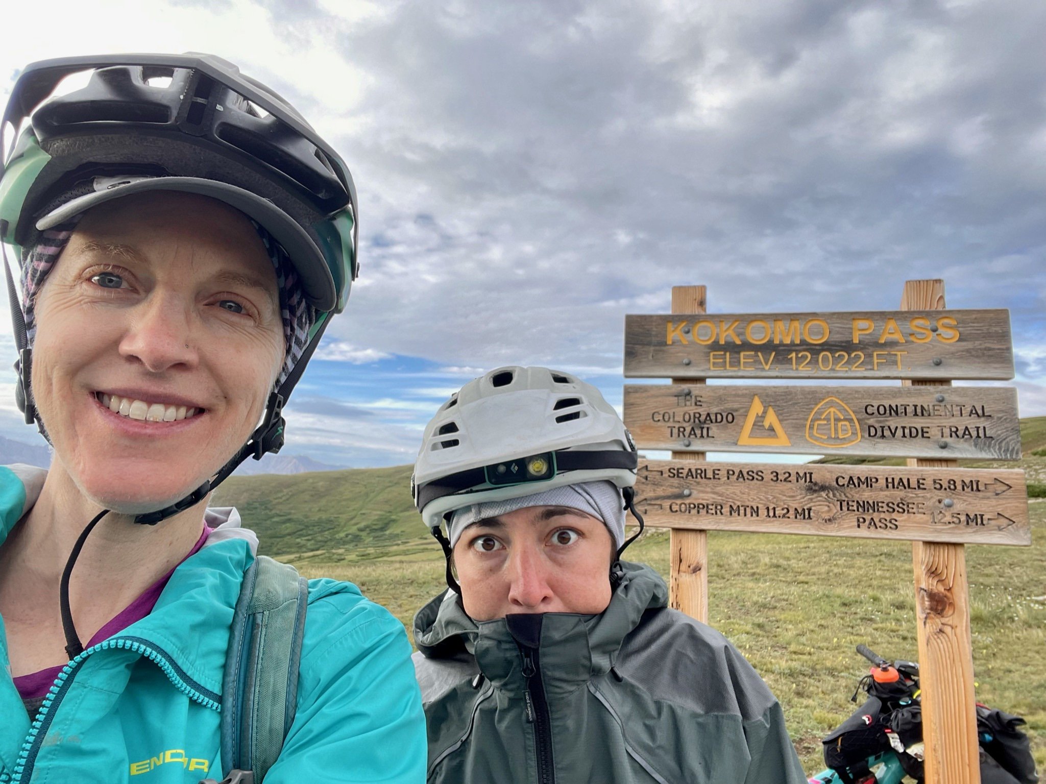
As the sun rose and we began to be able to see without lights, we were also cresting above the treeline and my mood lifted immediately. It was like we had transported to Ireland, or somewhere with rocky crags and spotted green patches of grass and I’m sure there were mountain sheep somewhere out there (though we didn’t see any). We got to Searle Passe at around 5:20am and celebrated with an obligatory summit dance. We crushed Kokomo Pass, which was our highest point of the trip so far at 12,022 ft. I think we did another dance, but it was short lived because it was friggin’ COLD up there! The wind about blew us over and it made us so glad that we had not ventured up there during a storm. We did talk to one rider who had been up there during hte storm the night before and said it was huge hail and scary lightning and thunder, which just validated us that we had made some smart decisions! Go team!


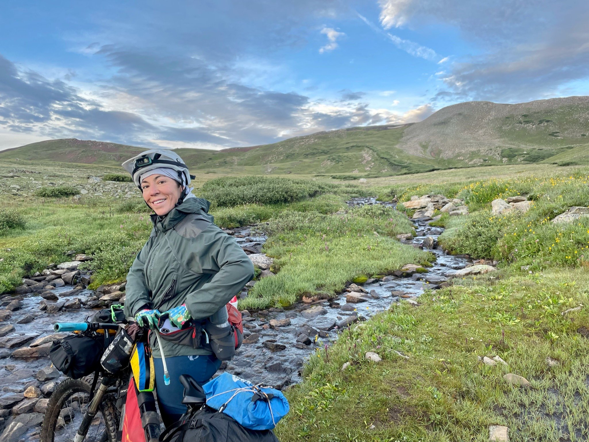
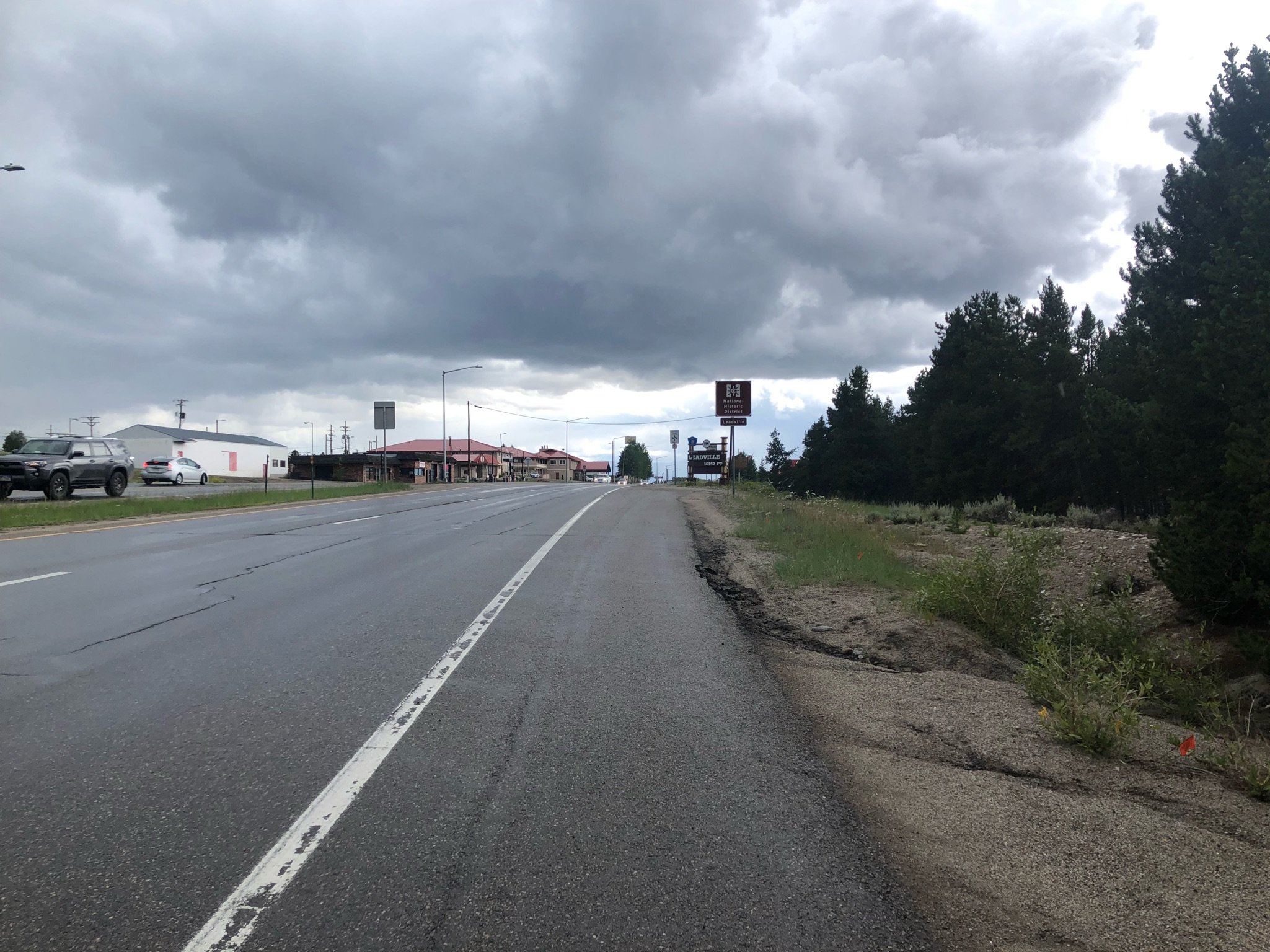
The descent from Kokomo was a blast. It was mostly rideable, as far as I can remember and it went pretty quickly, which was good because once again, the thunderstorms came right on time. The trail pops out on the road where the bike Wilderness detour leads toward Leadville. Though the pavement was fast rolling, the wind was strong. Aliza’s energy was waning quickly and her ability to put the pedal to the metal was long gone. We tried to motor together, but she wasn’t having it, so we needed to take it slow and steady. We were starting to realize that we would not be able to get to Buena Vista via our own two wheels unless we rode through the night because of how long everything was taking. So, we called ahead to the awesome Patty Sag wagon and he met us in Leadville just as the rain started pelting down. We hopped in the van and rode the rest of the way to Buena Vista where to our Airbnb where we would be spending the next day as a much needed Zero day. At first, I will admit that I was a bit disappointed by having to miss some of the trail and felt a little blow to my pride for getting some rides to specific points on the trail, but going into this adventure, Aliza and I had agreed that no matter what happened, we were in it together and we would make decisions together about what we needed to do to complete it together and that’s what we did! We went and grabbed dinner in Buena Vista - a cute little fresh foods place that I can’t remember the name of. Loads of laundry were done and we relaxed like nobody’s business.


Day 7: Zero Day: Buena Vista
Stats: 0 mi, Elevation Gain: 0ft, Moving Time: 0h0m, Elapsed Time: 24hrs

Our rest day was magical, but as with all rest days, I felt very restless. You go from pedaling your bike all day every day to doing absolutely nothing besides eating, resting, laundry, a quick bike wash and check and then going back to resting and eating. We ate Casa Sanchez Mexican restaurant and it hit the spot. This cute little joint had outdoor seating in their covered patio area and the meal included the most delicious sopapillas for dessert! We hear they sometimes include a shot of Tequila with the meal, but we didn’t order drinks in the first place, so they didn’t offer. We saw another table that got shots delivered all around, though, so I think the rumors are true!
We also had to make an obligatory stop to the bike shop in Buena Vista. My derailleur wasn’t shifting properly after a couple spills and some mud and grime, so I had them check that out. Aliza also got her crank looked at again. They got us in quickly and our bikes were ready to go in a couple hours. In the mean time, we treated ourselves to some mini belgian waffles in the little cafe that is attached to the bike shop. GET THESE IF YOU ARE THERE! They were only $3 or so for one and I could have eaten 10! (though I did a great job of restraining myself!).
We also ventured over to Cottonwood Hot Springs to have a soak.
The mineral hot springs in man made pools were a much needed reprieve for our tired legs. There’s also a little area where you can scramble down to the river next to the springs to take a quick cold soak, so of course we had to experience the thrill of immersing ourselves in cold river water. I’m a wuss with such things and while I soaked for a bit, I got out pretty quickly. Aliza was a champ and stayed in quite long. Patty even submerged his head under! His bravery would prove futile later though, because he started to feel under the weather and after some internet research, we “diagnosed” him with cold shock, which apparently can happen when going from one extreme temperature to the other. He felt very out of it and a bit dizzy and nauseous for the next couple of days, poor guy.
Anyway, I was glad we were only resting for one day and was anxious to get back on the trail. My grumpiness and tummy start to act up on rest days, though I know it’s so good for me, so I tried to just chill and headed to bed early after a good stretch session.

Patty in pure sopapilla bliss!
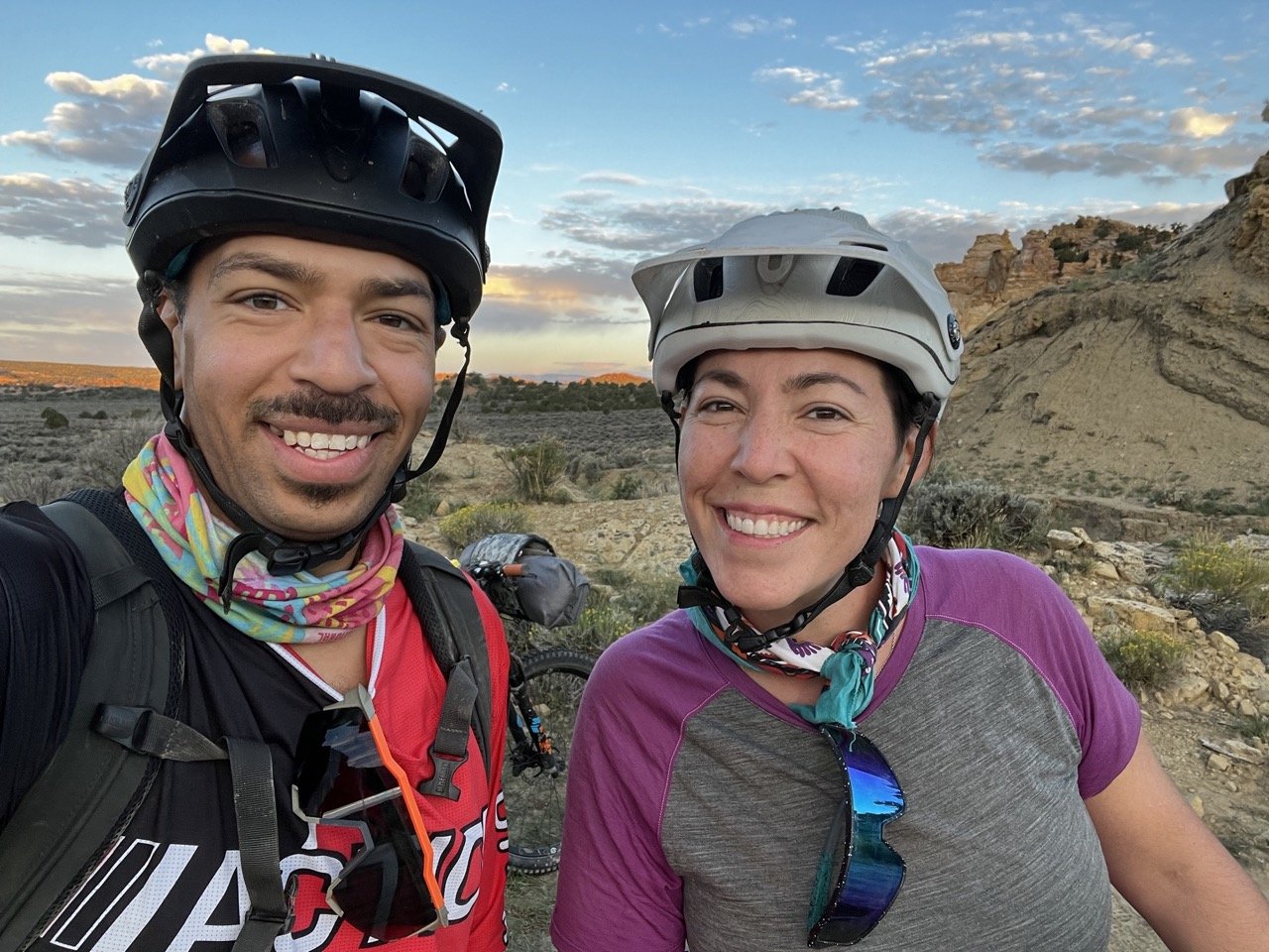
Day 8: Avalanche Trailhead to Shavano CG
Stats: 29.11mi Elevation Gain: 4688ft, Moving Time: 5h38m Elapsed Time: 8h54m

Ready to Roll at Avalanche Trail Head
Patty Sag drove us to the Avalanche Trailhead, which is where the bike wilderness detour meets back up with the CT proper. This way, we avoided a generally boring road/gravel climb out of Buena Vista. It was overcast and a little chilly and we assumed we were in for some weather that day.
The trail conditions in this section of the CT were spot on! We could actually pedal our bikes, it wasn’t too soggy and the ups and downs weren’t horrible. We did have to cross a couple of creeks, some of which had little bridges and some did not, but we were already sort of soggy anyway due to a misty rain, so it wasn’t a big deal to get our feet a bit wet.
Not too far into the ride, I managed to slide out a bit on a wet section and banged my derailleur again! Ugh! All the $$ out the door and now I had a derailleur that wasn’t shifting properly. I tried to adjust it on the fly and it helped a bit, but was limited in my gear options.


After descending off the ridge, we popped out on a road, so it was pretty quick riding for a while. This part of the trail is for both hikers and cyclists, and bypasses around private land. We saw a couple of hikers on this section, going the opposite way. I vaguely remember having a bit of a hard time mentally on this part, but I don’t quite remember. We stopped for a bit for some reason, but then obviously kept on truckin after a quick snack and a stretch.


At one point, after we returned to trail, we were on the 6.6 mile section where there are several water sources and good camping areas, though everything was just a damp soggy mess and we weren’t looking to stop here anyway. We did see quite a few hikers through this area. We decided to hunker down in a little shire area for some nom noms and ran into two day-hikers, young guys, who were out looking for mushrooms. The damp, moss and aspen covered hills definitely seemed like prime mushroom housing, and they showed us their bounty. They had foraged all types of mushrooms, some of which were definitely chanterelles, some lobster and some that they weren’t so sure about. They offered some of the chanterelles to us, and I took them up on it, but after riding with them for a bit they became a little too moist and broke down a bit so I ended up tossing them, but dang, they would have been good with my dindin!
From the end of this roller coaster trail, traversing down into creek crossings and up again and again, the rest of the trail was climb, climb, climb. From what I remember we could ride most of it, with small areas of hike a bike, but could be rideable if you had the legs. Somewhere in this area of the trail it had started raining profusely and we were soaked to the bone. We didn’t know how far we were going to get that day and decided to ride until we couldn’t any more. I think both of our morale was low and our rested legs wanted to rest for longer. We descended down a ways and the trail reaches the Angel of Shavano trailhead. Here, it was raining so hard, we could hardly see anything, so we pulled over at the day-use area at Shavano CG and joined some through-hikers in the pavilion in having a hot drink to try to warm our weary bones. The longer we sat there, it was very apparent that Aliza didn’t want to go any further that day. I probably could have made it happen, but we also knew that we had already done almost 5k ft of climbing that day, our legs were tired, and we had another big climb in front of us, which would lead to higher elevation, colder temperatures, and a chance of being exposed in a thunderstorm.


The rest of the through-hikers had decided to call it a day too and ambled their wet selves over to the campsites. We went and looked at the campsites and realized we were a bit late to the game, with no campsites open, we returned to the pavilion. It did say no camping, but we figured that we’d just go ahead and set up and if someone kicked us out, we’d let them deal with trying to find us a spot in the campground. We put our belongings in the outhouse, which was rather warm and we hoped it would dry things out a bit. Having the overhang at the pavilion as well as tables was a treat and we stayed pretty dry and warm for the rest of the night. We set up a tent on the pavement of the pavilion and stayed pretty warm! It was a great set up! And bonus! We didn’t get kicked out, though I do think we had a friend that visited us in the night and tried to munch our food. I always travel with a critter/bear proof Ursack and scent-proof bags, in which our food was stashed, so this staved away any critters that attempted to feast on our food.

Trying to find my mojo somewhere…
Bikepacking the Colorado Trail: Part 3
Day 4:Jefferson Cr. CG to Miners Creek Trail just past Breckenridge
Stats: 29.25mi, Elevation Gain: 4045ft, Moving Time: 5h14m, Elapsed time: 11h47m (including dinner stop)
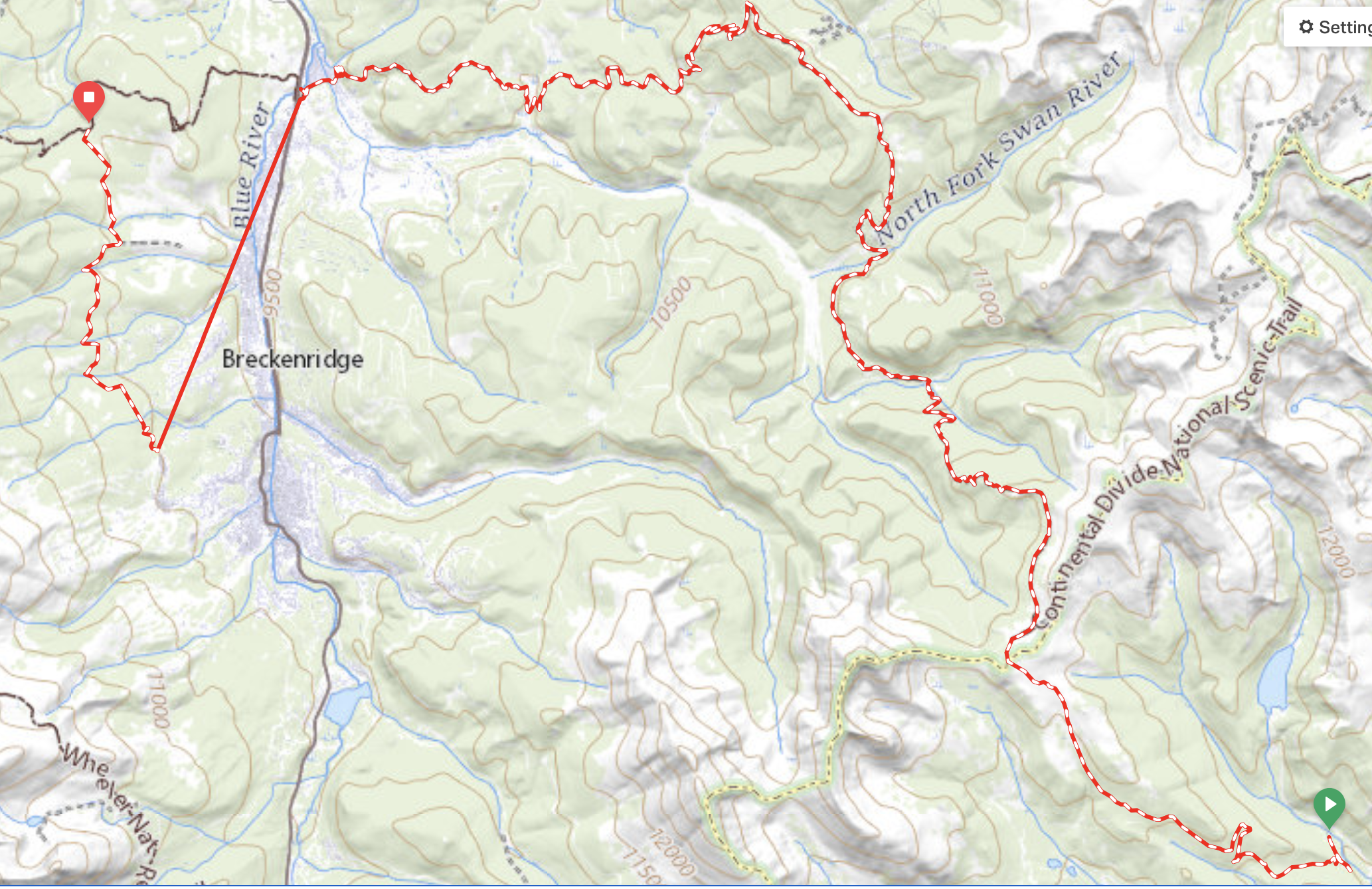
The morning started out beautifully. We had a lot of climbing to do in a short amount of miles, most of which were single track so we knew we were in for a big day. We were on the trail pretty early with some refreshed energy, which we would definitely need. We immediately started climbing up towards Georgia Pass. The clouds were grey and it was chilly, but not too bad as we got started. We expected that the climb would be difficult, but it was actually pretty rideable…until it wasn’t.


The trail turned from turned into baby heads, turned into goat heads, turned into boulders, even on the descent. From what I remember this didn’t last forever, though, and once started the descent proper down into Breckenridge, things turned for the better. We flew down the flowy descent, making all the switchbacks (for the most part) and had views for days. Our energy was pretty good, from what I remember, I think boosted by the fact that we’d have a good dinner in Breckenridge. At some point Aliza’s bike crank started having some issues, so we were in a rush to also get into town to make sure we could get to a bikeshop.


As we got off the trail to hop into town, it wasn’t obvious which way we needed to go right off the bat. We spent a bit of time faffing around because the bike/pedestrian path that is supposed to be the easiest way to get into town was closed for construction, so we were unsure what our options were. We connected with Patty Sag and made our way to Tiger road where he met us and we piled in the van. We were lucky that we made it when we did because sure enough, the thunderstorms moved in and the sky grew dark. We made the stops we needed for Aliza’s bike and to try to find me a handkerchief (failed attempt), and found a great spot for dinner, a couple of blocks off the main strip so it wasn’t as busy and we were able to immediately get a seat. As we were filling our bellies, the rain started to pour! I felt so glad to be inside and not shivering out there in the rain. Both Aliza and I knew, though, that from here on out we would be chasing storms for the rest of our trip, which we were not excited about!
It was getting late, so we picked up Aliza’s bike from the shop and Patty Sag took us over to the Peak’s Trailhead. He had suggested this way as the best way to get over to Miner’s trail where we would be camping. “It’ll be fun,” he said. “It’s not too climby,” he said… Half way through the up and downs of this “fun” trail, Aliza and I had cussed all the cuss words we could muster. Our legs, after spending a few hours at dinner, no longer felt the need to do what we needed them to. Plus the jump line we encountered on the trail wasn’t that spectacular on a hardtail 70lbs bike.
Either way, we finally made it to our camp just before dark. Tired, full, but warm, we set up camp quickly and fell asleep just our heads hit the pillow. The next day, we knew, would test our grit and stamina, so we needed to sleep well and get up early. As I was drifting off to la-la-land, I heard quiet voices and the sound of free-hubs next to our camp. Some of the racers who were traveling the opposite way as us were riding through the night. Glad to not be one of them, I drifted away and didn’t wake again until morning.


Day 5: Miners Crk to just below Searle Pass
Stats: 15 mi Elevation Gain: 4094ft, Moving Time: 4h32m Elapsed Time: 10hr05m

The weather had officially arrived. This day, we knew we needed to try to get over the pass and up 10-mile before the thunderstorms came in for the afternoon. We also knew that there would be much much hike-a-bike, but what we didn’t know is really how much hike-a-bike there would be. A lot of the 10-mile section is very technical and very steep. (See pictures below). At one point, there is a spot where the hill is literally straight up - I don’t even know the grade, but it was unrideable, shit it was un-hikeable unless you paperboy’d your way up.


So up we went, pushing and grunting, a tremendous heave with our loaded bikes. We saw one hiker through-hiker going the same way we were. Most of the hikers we had passed/run into along the way were generally good natured, easy to talk to and generally have a sense of the same passion that we have for being outdoors.
This one man, on the other hand, had a different countenance. From the onset, nothing but grumbles spilled out of his mouth. Grumble this, and grumble that. He was complaining about the steepness of the climb, and explained that whoever built this trail didn’t know what they were doing and that, “on the Appalachian trail, this never happened. There were always nicely cut switchbacks up the steep parts..” etc. etc. So, he didn’t appreciate the way that the trail followed basically the only way up this stretch of mountain, and he was letting everyone that passed knew about it, which at the time was only us, so we got an earful. We acknowledged that yes, it was steep, but just kept on going. Of course, we were saying all the cuss words in our minds as well and stopping to breathe every three minutes, but for me, trying to keep a positive mind about things is every bit as important as keeping my body fueled so it could push forward.


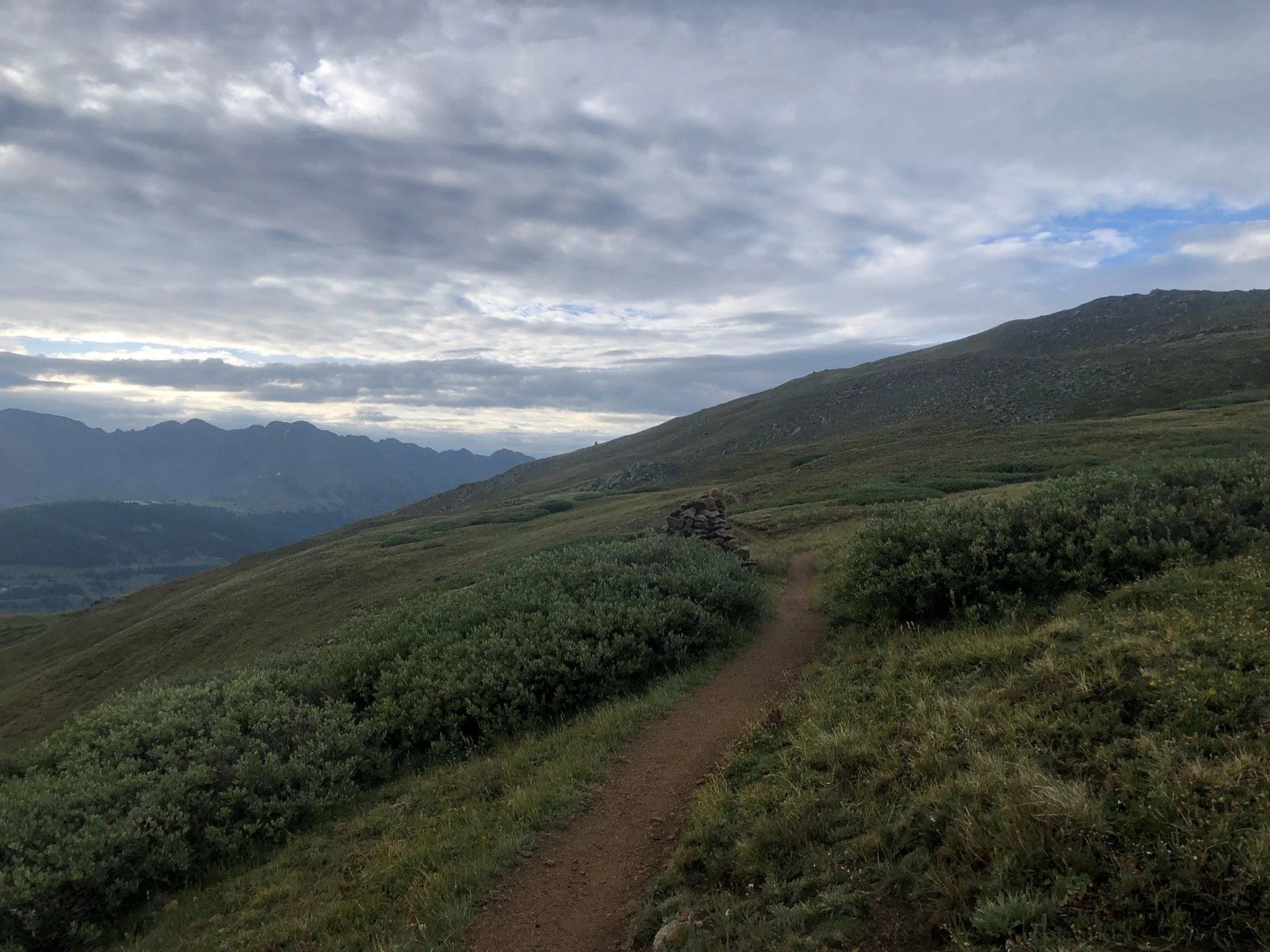
Ten-Mile section of the CT ascends 3,300 ft in 8.4 miles. It then descends 3,000 ft in 5 miles through 1.7 billion-year-old basement rocks that cover the crest as well as the valley below. As you travel along the CT on this portion of the trail, you cross under six or seven different passes and crest above the tree line for several miles of tundra riding with astounding views of the surrounding mountains below. You literally feel like you are on top of the world, surrounded by green and wildflowers and you can see for days. The riding through the tundra section wasn’t the worst, but was generally slow going at times with short technical, unrideable sections and some descent exposure (that I don’t deal well with).


Once you crest on 10-mile/Miners and head towards Wheeler, you start to descend down towards Copper Resort. We had staved off eating lunch until Copper because we wanted a proper place to sit, a cold coca-cola and any other fun munchems that the market might have. One part of the rocky descent just down from the crest got a little rowdy.
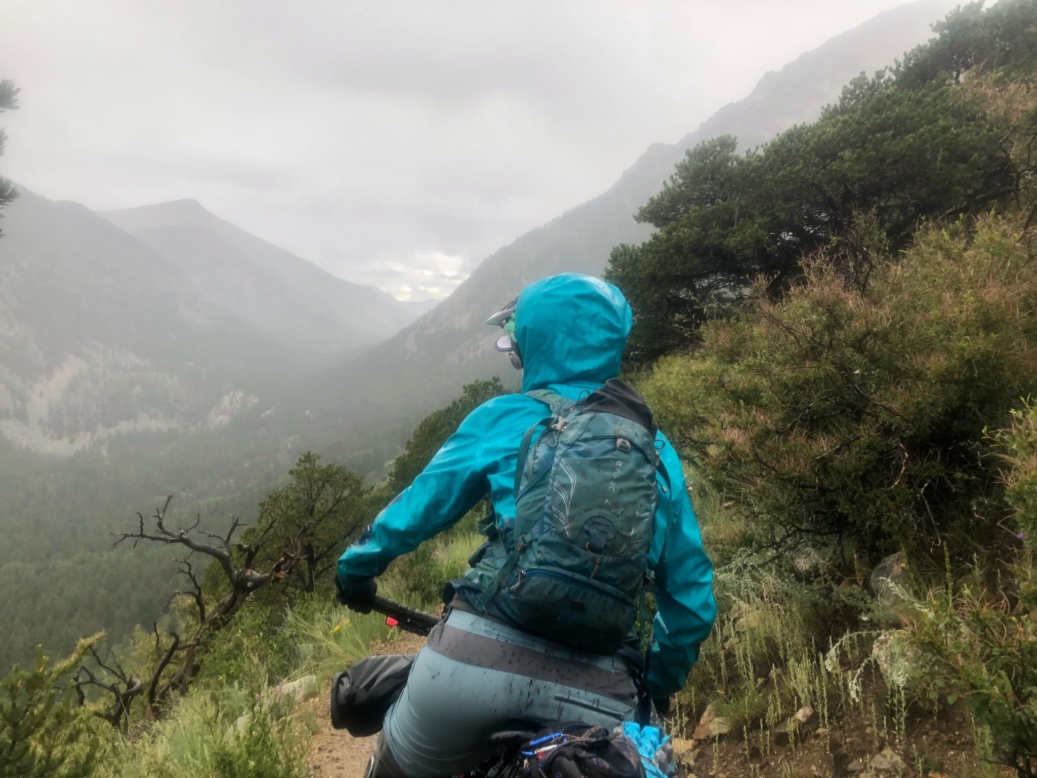
Aliza is a daredevil, and as I mentioned in a prior segment, likes to do anything she can as to not have to walk or push her bike - partly out of the condition of her knee, but I think also to do with a little with her pride. The trail was getting precariously steep and while I definitely would have ridden it with a not-fully loaded bike, with some suspension, with a dropper, I chose to get off my bike and take a look. It seemed a bit too risky to me, so I got off and started walking. But Aliza? Not to my surprise, Aliza started bumbling her way down the bumpy pathway, trying to navigate her way down without gaining too much speed and not hitting any of the human-head shaped rocks in our way. She got about a quarter of the way down when her front wheel got bumped off course and away she went like a lost cow, stampeding through the brush. I thought she was in for, but she managed to slow herself enough eventually to where she just tipped over into the brush. It was a sight to see! I had to stop hiking my bike because I was laughing so hard and was grateful that I didn’t have to pee, cause I surely would have wet myself. Needless to say, I was very satisfied with my decision to hike my bike and myself down the rest of that part of the trail.

Me, making smart decisions!
As the trail re-entered into the tree line, the descent became more rideable and more fun, flowing into a few switchbacks and more wildflowers. We were almost to the bottom when I managed to take myself out and landed on my tush off my bike. I got distracted by all the beautiful landscape and suddenly I was on the ground. I didn’t get hurt though and laughed about how ridiculous I felt for falling over on such a non-technical part of the trail.
You can see Copper Resort as you descend off the hill, but it seemed to take forever to get there. What I thought would take us just a bit of time ended up taking quite a bit longer because it was up and down and up and down. I was ready for lunch! Also, it was early afternoon and we could see the storm clouds rolling in like clock-work. It was here, on the roller coaster trail that we ran into a couple of other cyclists who were racing and going the opposite direction from us. One especially looked haggard and talked to Aliza for a bit while she waited for me to catch up. Little did I know that two years later, this guy, Mike, would become one of my good riding buddies and would ride the Kokopelli trail with me in 2023! It’s such a small world!


We arrived in Copper resort and made our way to the market just in time for it to start raining. We sat on a bench near the market and I warmed up my dehydrated refried beans for my bean burrito lunch (yay for hot lunch!) Aliza was also snacking on the smorgasbord of nom noms that she had in her pack as well as what we had picked up from the market. Our glorious lunch was brought to a halt as a raging storm blew through. Crazy hail and wind bombarded all the tourists and they scattered like sheep. We hunkered down along with a few other CT racers who had stopped for lunch and a recharge as well. They were contemplating whether and when to go back out on the trail, as they were starting to head up the mountain the other way towards 10-mile. I, personally, would not want to be up there during a thunderstorm, but some of the guys were saying they were going to risk it. All for the race, right?

Calm before the storm. CT racers had made a pitstop as well!
Aliza and I hunkered down trying to decide what to do and finally decided, after the clouds broke just a bit that we needed to make it as far as we could until the next storm system. So we bundled up in all of our warm gear, and our full tummies and started the climb up to Kokomo Pass. On our way out of the resort we ran into one other lady racer so we cheered her on with our words of awe and encouragement! The rain cleared just for a bit with only sprinkles and we were immediately too hot in all of our gear, so we had to stop and strip down. But, as nature would have it, not even 30 minutes later, it was pouring again.


We could tell that there were going to be a few storm systems rolling through, each bringing with it wind, more rain, and then ebbing just a bit before the next one, so our plan was to make it as far as we could get just below the tree line, and then call it for the day. We were wet and tired and ready to be done. On our way up, we kept looking for a site that was somewhat near water that one of our friends had mentioned on his CT trek. We even had a pin dropped where he had stayed, but when we got to that point (or what we thought was that point) there wasn’t really any where to camp, so we kept going. Finally, we found a little spot just off the trail that seemed to be a little covered by trees, which we thought might help keep things a little “dryer.” The only problem was that we weren’t near water, but we didn’t want to risk going any further up and not having a camp spot. So, we pitched the tent in the pissing rain. Aliza agreed to start some hot water if I would go on the hunt for water that was about a mile up the trail. So, I got most of the bladders so that we would have enough for the rest of the day and the next morning and went for a hike.
The hike was actually quite enjoyable. It was all uphill on the way up, but not too steep and it was absolutely beautiful in that area, overlooking meadows, a ton of trees, and even with the rain and setting sun was quite magical. I got to the water source, which was just right off the trail and easy to get to. I was just minding my own business passing the time in my own head, when guess who I would run into at the water source? Our Grumpy Curmudgeon friend from earlier that day. I said hello and at first didn’t recognize him with all his rain gear on, but as soon as he started talking, I knew his cynical voice instantly. He had a lot to say about the rain, and then asked if I knew if there was an open campsite ahead and that “there better be an open site because he’d walked all this way and wasn’t going to go over the *#$% pass tonight…” and other grumblings of the sort. If any of you have ever read Bill Bryson’s book, “A Walk in the Woods” about his Appalachian Trail experience, you could probably imagine that this person is similar to Bill’s friend that accompanied him on the majority of the trail. If you haven’t read it, you should - it’s a great read. Anyway, he trudged on and left me in peace and I hurried my way back to our camp and arrived just at dusk.
We huddled and cooked our food quickly…in fact, I’m not even sure if I ate a hot dinner that night because we had had lunch so late. Either way, our bed time could not come early enough. We planned to wake up before light the next morning and ride in the dark up the hill so that we could most assuredly get over the pass before the thunderstorms hit, which proved to be a very very smart move on our part.
PS: No matter how much I try to remember to get pictures of the grumpy/no good/rainy and cold parts of the trip, I always forget. So, pretty much we had no pictures of our trek after our rainy lunch at Copper Mt Resort. I’m sure you can use your imagination though.


Bikepacking the Colorado Trail: Part 1
The Colorado Trail is a 468-567 mile through-trail that runs East-West from Denver to Durango. The CT was originally completed in 1987 after Gudy Gaskill founded the Colorado Trail Foundation in 1986 with the main mission of the organization was to compete and maintain the trail. The trail in its entirety is kept up by the continued work of the Colorado Trail foundation, which is volunteer led. Work on the trail is mostly done by the organization who work in cooperation with the US Forest Service. As you might imagine, keeping up over 400 miles of trail is a daunting task so the efforts of these volunteers is a fundamental part of the trail's continued existence and use. After experiencing the beauty and epicness of the CT, it is astounding to me that such a large stretch of trail has been kept in such great condition over so many years. Thank you to all those out there who provide their time and energy and money to help keep this trail in existence!

Aliza at Lenny’s Rest
Bikepacking the trail is quite a feat. People have been traveling the trail on foot for years, but only in recent years has bikepacking the trail as a through-ride become more popular. It has been said by many bikepackers that have attempted the CT that it is a hiking trail that you can ride your bike on. I can readily confirm that is the case. With a ratio of probably 60/40% ride time to hike-a-bike time (of course depending upon your fitness level and technical riding ability), the CT is no joke, especially if you ride self-supported with all your gear that you would need for anywhere from four days to a few weeks. The Colorado Trail Race is a bikepacking self-supported race that takes place every summer with a grand departure in late July, alternating years going East to West or West To East. The race’s inaugural year was 2007, starting in Denver and heading West towards Durango. The race, at the time, had only three rules:
Race from Durango to Denver, self-supported, under only your own power, along the entire CTR route
No pre-arranged support, with the exception of mail-drops to a post office and only a post office
Don’t break the law
There may be a few more rules at this point, but overall, you get the gist. There are no prizes, no finish line glory. Just the bragging rights to say that you completed the trail in the fastest time that year, and of course, peeps are always vying for the FKT. Though I commend these folks for racing the CT, I honestly don’t know how they do it. I felt like I was at my max most of the time and it took us 14 days to complete (most) of the trail. I am amazed, especially by the chicas, like Alexandera Houchin, who completed the course in 6 days, 2 hours, and 33 min in 2022! Yes girl!

Me. In a lot of pain from separated shoulder. Eating Icecream, cause why not?
When my bestie, Aliza, and I decided to ride (not race) the CT, we knew it would take probably about 2 weeks (at least), so we put it on the calendar…in 2020. Well, as we all know, COVID had other ideas. I also separated my shoulder during a fun ride up in Oregon a couple of months before our scheduled trip. A few weeks before our scheduled departure, we knew it wasn’t meant to be and we tabled the ride until 2021.
The next year rolled around and everything fell into place. The weather was looking good, snow levels were perfect, and we both got the time off of work. Better yet, my boyfriend Patrick (Patty, aka Patty Sag), offered to be a SAG wagon for us and drive Aliza’s van to meet us every few days, so that we didn’t have to ship anything or worry about resupply. This was great news, especially since Aliza deals with quite a few dairy restrictions, so it meant she would be comfortable the entire trip and not have to worry about resupply at small markets and things like that.
Aliza and I are both experienced adventurists. We have ridden significant portions of the Great Divide MTB Route, Baja Divide, completed the entire Oregon Timber Trail, Kokopelli Trail and other smaller multi-day Type-2- Fun adventures, so we felt like the CT was the next level up. This would be the first trip that we would have to plan away from each other because I had moved to Phoenix in 2019 and she was still in Portland, but after many FaceTime calls and emails, we managed to pull our trusty spreadsheet together. Our spreadsheets looks something like you see below. We each can edit it at leisure and it gives both of us a good opportunity to familiarize ourselves with the trail, what to expect, etc. We both had a copy of the Colorado Trail guidebook, which you can purchase here. We also include things like links to lodging, confirmation numbers, phone numbers, etc and make sure to share the document with our loved ones and close friends so they can keep tabs on us and make sure we are safe!

Our nifty little spreadsheet!
The plan was to meet each other in Durango; Patty and I drove up from Phoenix together and Aliza drove from Portland in her van. We were lucky enough to be hosted by a friend’s friend’s mom and step-dad in Durango. Joan and John were the best hosts! They whipped up some popcorn for our arrival, made sure we had plenty of snacks and beverages and had a garage in which we could store bikes and gear. Best yet, their place was even right next to a trail head so we could go spin our legs out!


Getting acclimated in Durango for a couple of days was helpful - even though it was a couple of days, it gave us both a chance to feel crappy on the bike before heading out on the CT. We loaded up our bikes with our gear to make sure everything was working correctly and went out for a spin. It was rough! I felt like I couldn’t ride my bike, couldn’t catch my breath, and wasn’t having a ton of fun. It made me rather nervous, considering I was going to have to do a lot more riding up crap-ton more elevation and with a lot more weight on my bike, but just tried to brush it off, knowing that the altitude had a lot to do with how I was feeling and that it would get better with time.
Our ride the second day took us from the house. I can’t remember which trails we rode, but it was basically, climb, climb, climb, and then descend down some pretty fun technical/switchback descents. In proper Colorado fashion, it started raining just as we finished our descent. By the time we got about two miles from the house, it was pouring rain, and we huddled under a large tree, contemplating whether it would pass quickly or if we should just dash home and get soaked. We chose the latter, and sprinted toward the house. We showed up looking like the three drowned mice. I figured we’d just need to get used to it because we’d definitely have to deal with the thunderstorms on the trail.


The morning of our departure, Joan whipped us up a delicious frittata and sent us on our way with coffees in hand. The drive to Denver seemed to take forever. We got to town just in time to swing by the REI and grab some last minute items/foods and then ate dinner. We were originally planning on camping somewhere near the trailhead, but since it had been raining that day, I contacted my friend Will and he graciously invited us over to stay with him and his girlfriend for the night. We’d be leaving early in the morning so this was perfect so we didn’t have to worry about taking down camp before we rolled out.
At Will’s house, we unpacked our crammed bikes and gear and outfitted everything up so we wouldn’t have to worry about it in the morning. I was glad we did because as I pulled out my bike, I noticed that the rear tire was completely flat. Ugh! There was a huge sidewall gash, which must have happened when we were stuffing all of our gear and three bikes into the back of Aliza’s van. Luckily, because it was way too late to try to hit up a bike shop, Will had a brand new tire that I bought from him and we got it squared away with not too much hassle. (Thanks Will)! Will was a peach and put up with us nervous chatty Kathy’s. He has completed the CT race a couple (few?) times prior to that year, so knew what we were in for. He regaled us with his stories of terror and awesomeness of his experiences - I don’t know if it helped or made us more nervous, but it was still exciting to hear about some of the places that we would soon see with our own eyes.
The next morning came all too quickly, and as I rose to pack up and roll out, I realized I was not quite ready to be missing the comfort of a shower and bed and my tummy was a little nervous. I couldn't eat breakfast, but figured I’d get something down once we started riding. The trail terminus was about a 30 minutes drive and it went fairly quickly, especially so early in the morning. We unloaded our bikes and made sure we had everything. Obligatory picture time was had, and away we went!


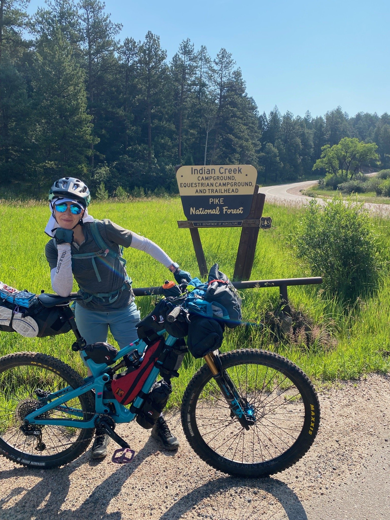
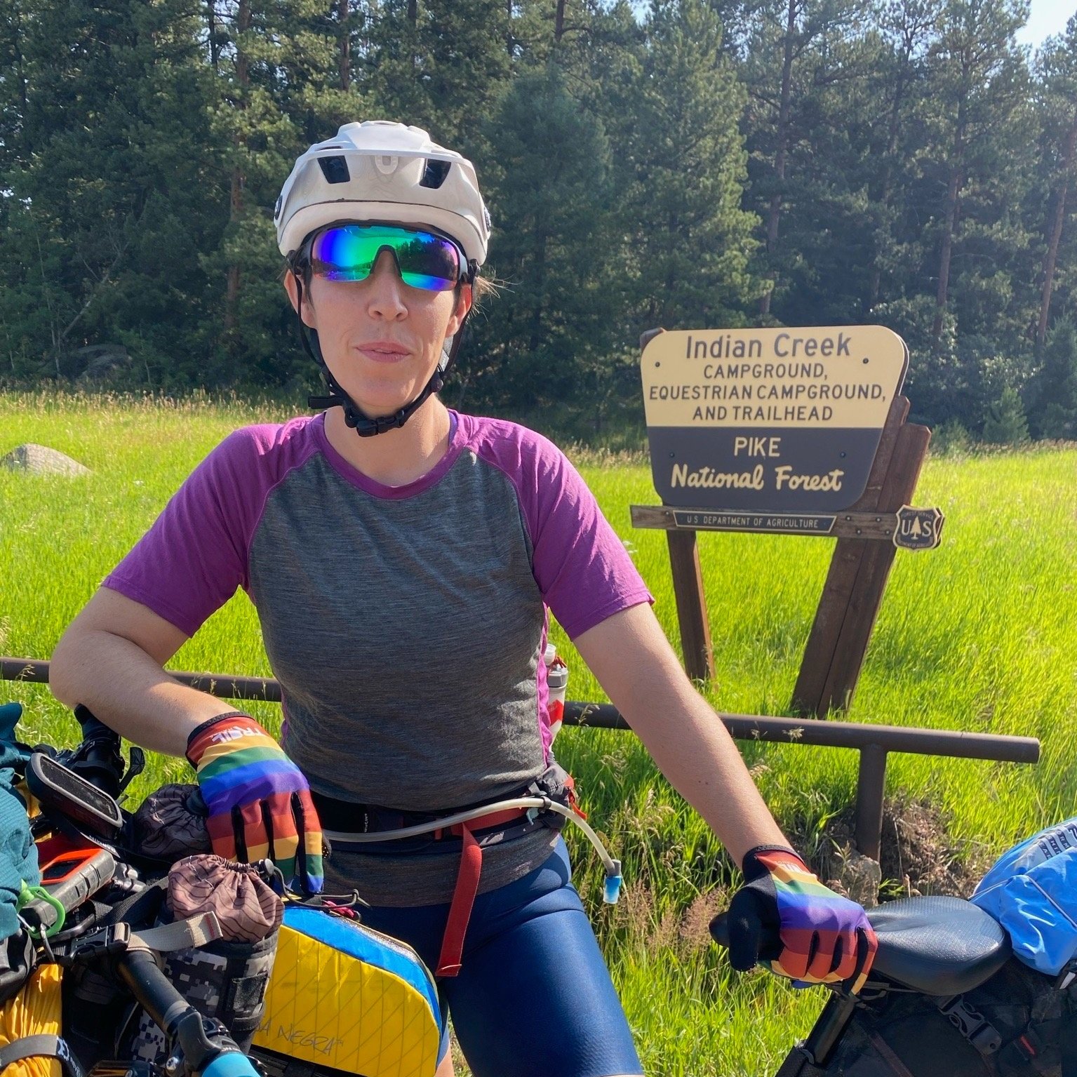
Day 1: Indian Creek TH (East Terminus) to Buffalo CG
Stats: 31.6 miles, +4695 ft, Moving Time: 5h49m, Elapsed: 9h03m
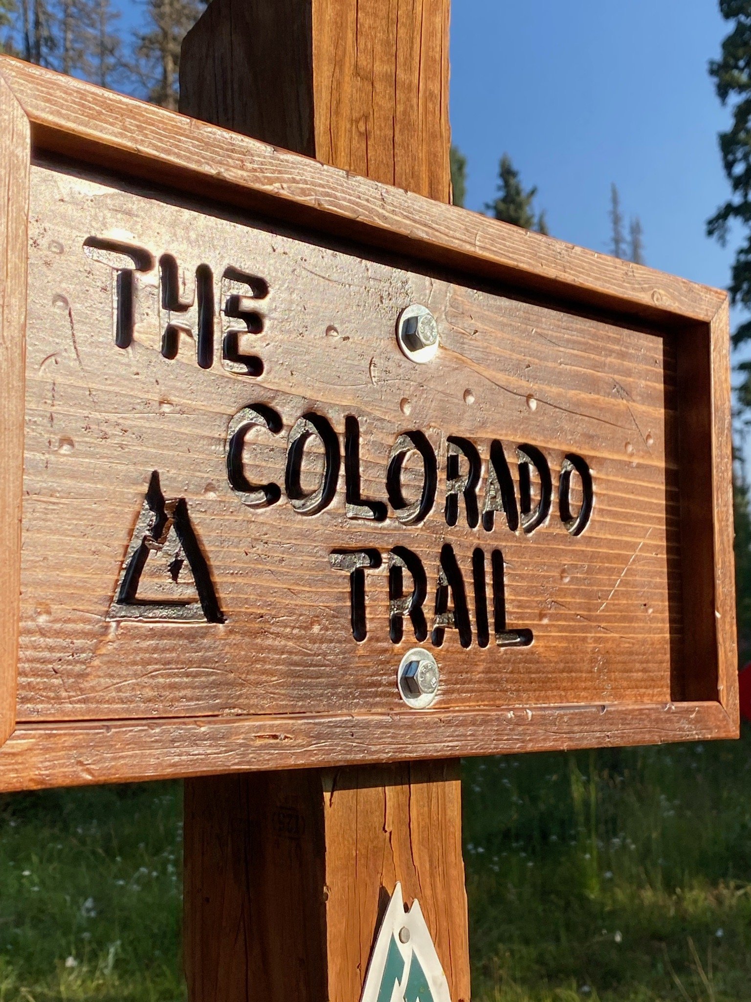
We arrived at the Indian Creek Trailhead at around 7:00 am on July 26, ready to ride. It was a clear, cool morning, which was perfect for the start of our radical adventure! Feeling some nerves and jitters, we double and triple checked that we had everything we needed. Picture time was had, and off Aliza and I went, leaving Patty Sag behind. We would see each other in a few days.

Rolling out on the CT!
The trail from Indian Creek TH was lush and somewhat overgrown but it was a short, fun descent. We quickly got our “trail eyes” on and then realized, but as soon as we reached the bottom, we realized we would have to climb out of the valley that we just descended into. We reached the famous bench at Lenny’s Rest by about 9:15am and took a brief reprieve. We were officially on the Colorado Trail.


The hike-a-bike began early in the day and it was no joke. Aliza was on her last leg (literally) with her knee. She has since had a total knee replacement, but at the time, the hiking with her bike was not kind to her. She had really been working hard with her physical therapist and on her own to get ready for the trip, plus her brace helped her stability, so she was doing the best she could, but we both knew that her knee, which she aptly named “Hermio-knee” would be the weakest link on this trip. I was still dealing with stability and strength issues from my previously separated shoulder, and hoped it would hold up. I only felt it give a couple of times up the hill, so figured I would be able to make it the rest of the way.


We made our way up the bush-lined trail, which seemed to never end. Through-hikers that we had passed earlier in the trail leap-frogged with us the rest of the way up, making me question why we were hoisting 70 lbs of bike up this trail, though once the descent began, it made me gloriously excited to be on two wheels!
I honestly can’t remember much about the trail between the hike-a-bike section and the exposed burn area toward the end of our day. I know it was hot, which Aliza really struggled with. My training in AZ helped me acclimate pretty well, which I was grateful for (cause it was still a difficult ride). After a flowy descent, we started climbing again into a vast clear cut area that is recovering from the Hayman Fire of 2002. The openness of the landscape was unreal to ride through and was a complete change from the lush greenery and towering trees that we had just exited. Here, we were exposed to the elements including the heat and the wind, which were relentless. On top of that, the dirt was quite loose, so any time it pitched, our tires would slip out, causing us to dismount and hike our bikes. Aliza killed it in this section and I suffered hardcore. Even though she suffered from the heat, her strength and mental determination to not have to hike her bike more than she absolutely had to helped her get up those steep pitches. We eventually got through the burn area and made our way up to the unmanned fire station where there was a water spigot. It was time for a break!


We hadn’t seen anyone else on the trail for quite a while. We began to record our daily trail report when lo and behold, a young man came out from behind the station to say hello. This through-hiker had been taking a siesta in the shade to avoid the heat of the day and was about to get on his way. It was fun to talk to someone about the trail for a bit. We had found a “trail angel” Coca-Cola on the bench near the station and we told him he should have it since we would probably be able to reach someone/somewhere with a cold Coke well before him, since we were on bikes. After snacking and chatting a bit, we were on our way since we had a ways to go until our stopping point for the night.
We arrived at Buffalo Creek CG early in the evening. I think there was water for us to rinse off, but I can’t quite remember. We set up camp early in the evening and laid down for an early night, as would be the case for pretty much the entire trip. This is one of my favorite things about backcountry adventuring. There is something fulfilling about the simplicity of working hard all day, being with yourself in nature, sleeping and waking with the sunrise and sunsets and only having to worry about moving forward, keeping your body fueled, and your mind strong.

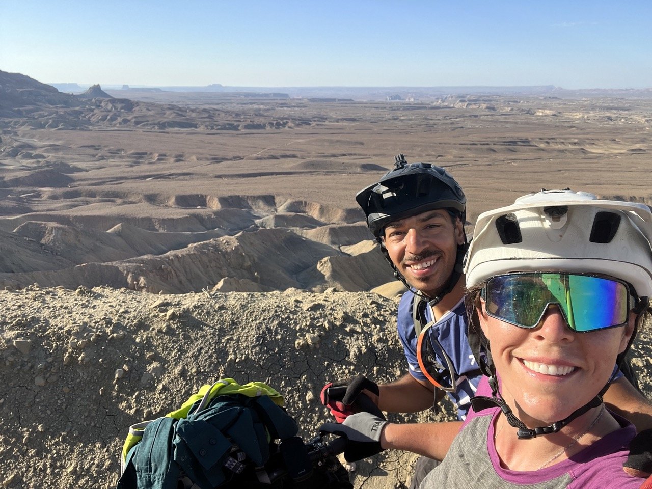
Grand Staircase - Escalante Loop (aka The Loop of Doom) Day 4
3:30am came quickly, and the three of us woke up and hustled to get out of camp so we could climb the morning in the dark. Patty wasn’t feeling so hot because he had been overheated and couldn’t cool down enough to sleep very well. He had doused himself in the creek several times that night in an attempt to cool down, but he still wasn’t very comfortable. I had slept alright and was excited to get this final day of riding in the books.
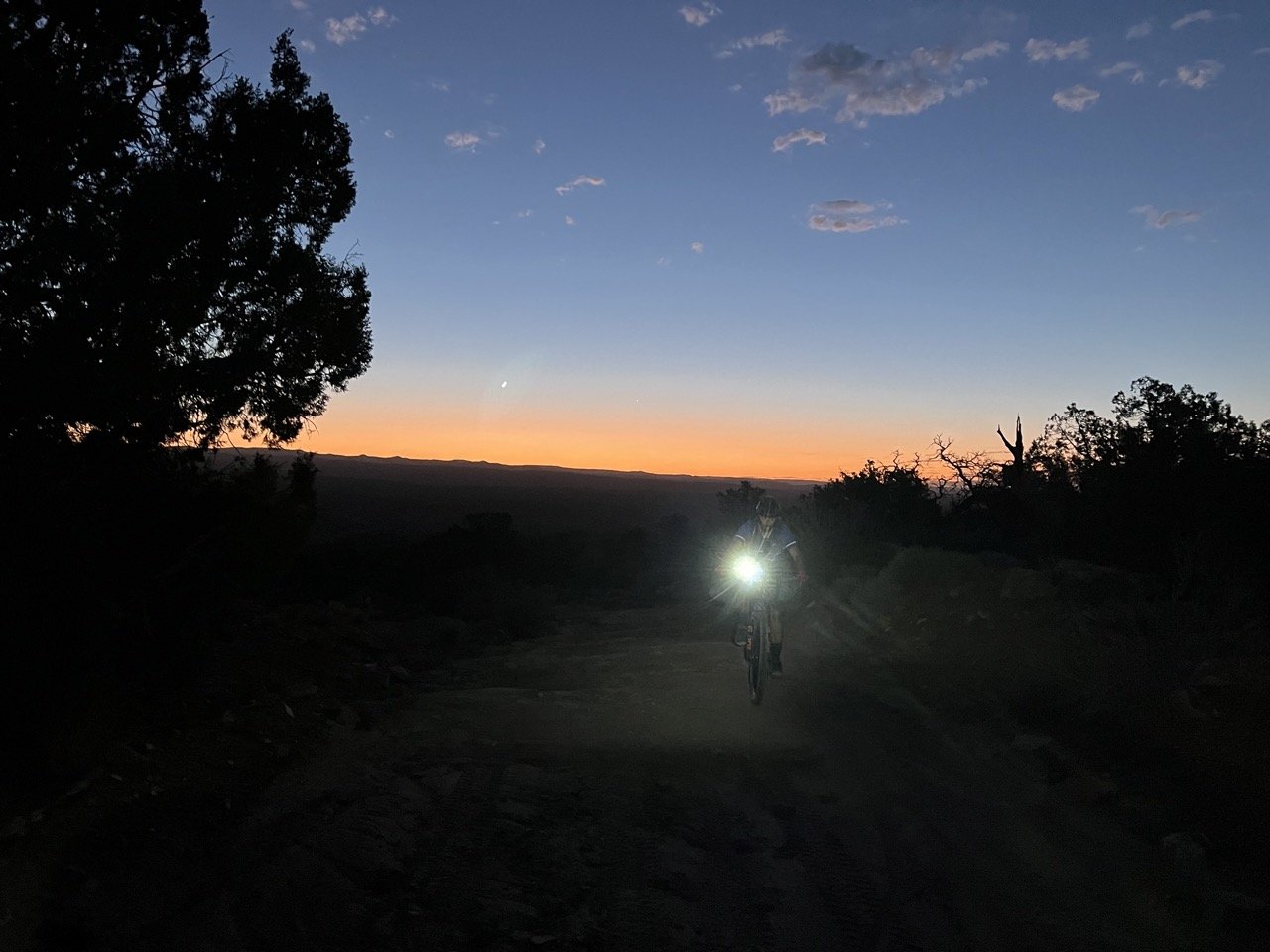
The stream was, of course, in a small valley that we had to climb out of, so we started climbing the morning. I found it was actually mentally motivating to ride up the hills in the dark. You can’t really see how far you have yet to ride to get to the summit of a climb, and you only just focus on what is in front of you. Plus, though we were trying to hurry and get as far as we can before the heat came, the experience of riding into the sunrise and arriving at the top of the mesa in the morning sun was worth the early morning wake up call.
Ryan seemed to be a bit more motivated than Patty and I to get to the finish line, and so he rode ahead for quite a while. I knew we had to take our time or we’d be scorched and out of energy by the end of the day, especially with Patty’s lack of sleep. I was trying to keep up with Ryan when I noticed that Patty was having a hard time keeping up, which isn’t like him. Every time he’d catch up, he’d fall right back behind. FInally, I let Ryan go ahead and waited for Patty. He had been carrying the drone in the bottom of his back pack and the pressure on his low back had been pressing on a nerve and his leg had finally gone numb and he was in a severe amount of pain. So we unloaded his pack and he laid down for a while, trying to see if he could get the feeling back in his leg and stretch out his back. Ryan eventually came back and took the drone on his pack.
A much relieved Patty was able to get back on the saddle and away we went. At some point in the day, though we were hustling, Ryan kept gaining distance on us and we lost sight of him. We knew he wasn’t having a very good time and wanted to get back to the car as soon as possible, so we figured he just went ahead. We kept motoring, eventually getting closer to town. Finally, after riding the roller coaster generally up rollers that we had been all morning, we got to the top of Kelly grade. This is the notorious steep, winding descent down from the mesa into the valley. The views were out of this world and Patty and I took a few moments here and there to stop to appreciate the scenery. As excited as I was for a descent, this descent is not to be trifled with. I live for descents! I have a history as a road cyclist and my favorite thing to do would be to bomb down the west hills of Portland, OR at 45+ MPH when I could. I love cornering, I love pushing it. But! Here I was, loaded with a 60 lbs bike, hoping that my brakes wouldn’t overheat or stop working, trying not to slide out on the tight corners, catch a tire in the huge ruts running parallel with my wheels all over the road, and keep in control on the occasional rocky-ass goat-head sections. Our short stops for a quick pick were definitely necessary to wring out my fingers and shake out my forearms and give my brain a break!
Just as the sunlight was starting to shift towards evening vibes, Patty and I motored into town. It felt like it took forever to cross the final straights, but we were incredibly thankful that we didn’t have any horrible headwinds, because this part is notorious for taking forever if there’s brutal winds. With a little energy to spare, but glad to be done, we got back to our car. Ryan had already come and gone, mentioning that he may or may not have thrown up when he got done and went directly to the closest service station to get all the electrolytes and coca-colas to try to recuperate before heading home. To this day, I haven’t seen him back on the bike and heard a rumor that he made a purchase of a motobike three weeks later. That’s how much this route sucked the lives out of each of us!
Some of these adventures that I put myself through are bike-cations. And some are definitely Type-2-Fun, where I say - “You know, that was really hard, and I suffered, but I would do it again, or I would recommend it. Then there are those adventures that are Type-3/4-Fun where I would never feel the need to experience it again, nor would I put it on my list of recommendations for folks out there. So, take it or leave it for this one! I know many other people have done it and highly recommend, so I also firmly believe that in any other given season that isn’t right after horrible monsoons and storms, it might be a little more bearable.
Signing out!
Keep calm and carry on...
Where's the Water?
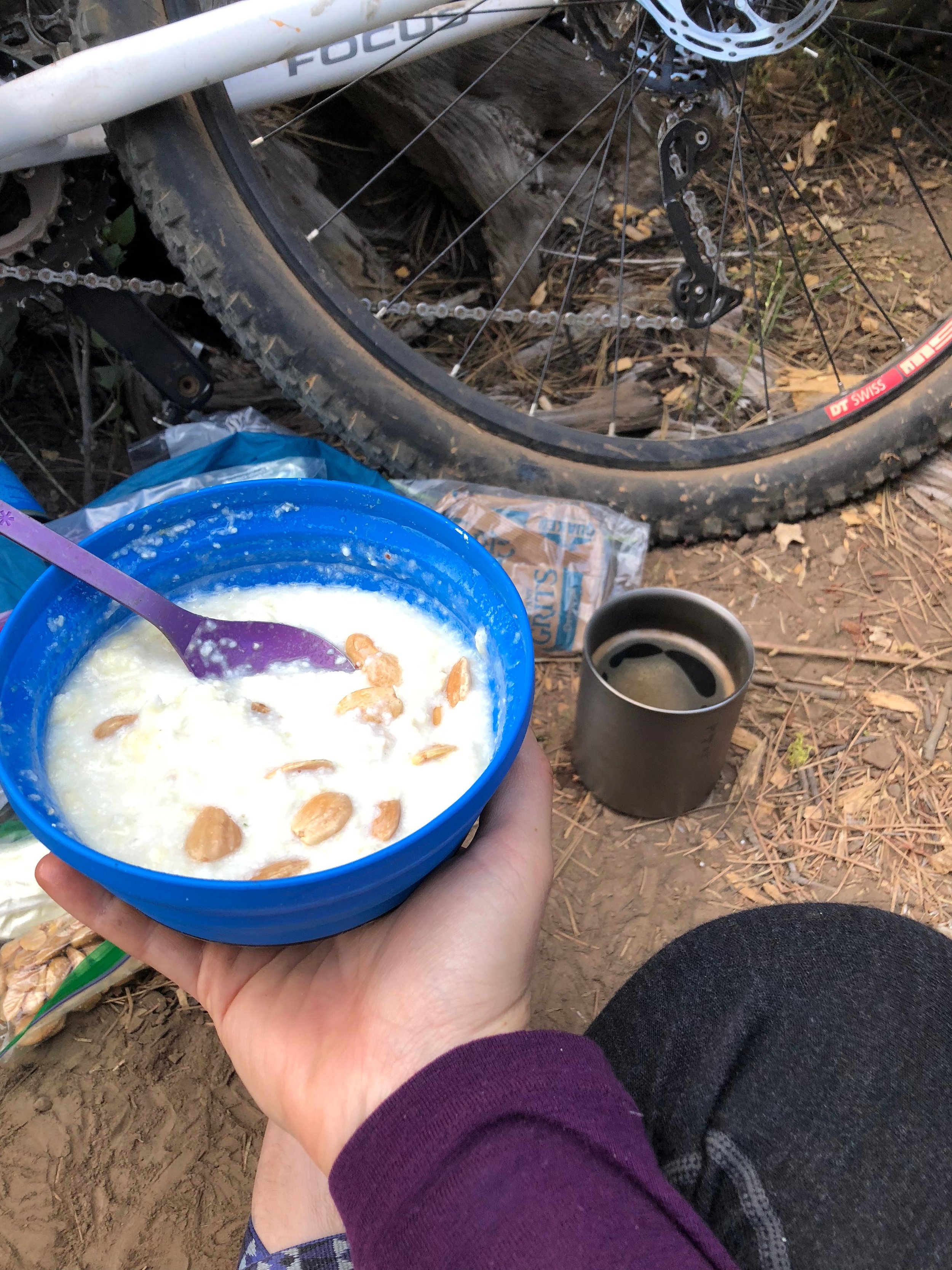
After the first epic day of hot-as-hell riding we were a bit shell-shocked but ready to rock it when we awoke to the chirping birds bright and early the next morning. We made our breakfast, which for me usually consists of 1.5 packets of grits with some powdered butter and egg whites, truffled almonds (special treat), and coffee. We had a meeting about the day's plan and made it on the road by 8:30 am, which, for five people trying to get all their 75 pieces of belongings together and out the door by then is making pretty good time. I will be honest, that I wasn't sure how my legs were going to hold up. Because of all the cramping on day one, I was going to try to avoid anything that I thought had made me cramp. I began the morning by downing a full bottle of water, and then another with electrolytes, I stretched, and then tried to take it as easy as possible in the beginning.
Due to the potential lack of water available on the trail for the entire day, we decided to skip some of the single track and take the road up to Crooked Creek Trailhead via a short detour to Mud Creek CG to fill up on some water. Because all of us were pretty paranoid about the water situation, still recovering from the heat the day before, we filled up extra, so we were pretty loaded with weight as we began our climb. This steady climb eventually dropped in at Crooked Creek trail where we ran into trouble. The trail was awesome, it was fun, it was bumpy, we went through a few dried creek beds, skirted around the lush trees and bushes, and then suddenly Deann's rear seat post bag-cradle snapped clean off her bike. Her husband, Bill and her attempted to remedy the situation by jerry rigging the cradle with zipties and tape, but it wouldn't hold. So, Deann ended up distributing most of her things to Bill and rearranging to rest to her front roll. It was not the most ideal situation, but at least it got us back on the trail.

We continued rolling and found a great lunch spot by a sparkling spring. (Turns out we didn't need to be carrying so much water, but I suppose it never hurts). One of my favorite things is a lunch time near a creek. It means you get to have all the water you want to cook with lunch (if you need that), and you can probably even have an afternoon "iced" coffee! It also means you can take a bath which is such a treat! So, of course we did all those things and started rolling again. That so-fresh-and-so-clean feeling did not last long, as we immediately ran into ALL the cows, which were walking the same trail. This also meant that ALL the cow dung was flinging everywhere; on our bags, on our clothes, on our helmets. It was pretty gross but fortunately we after some glorious descending, we ended up toward the end of the creek near the trail head and got to take bath #2.

During our descent we ran into two hikers out on the trail who worked for the Forest Service. They also had an adorable golden doodle named Sadie. We chatted with them about the OTT alliance and all of the great work they have done. They mentioned being excited that people are using these trails, and I'm hoping that they will continue to see more people out there as the OTT becomes a more well-seasoned route. As we were leaving, Heather casually mentioned our water worries to the forest, to which they said thank you to the feed back and mentioned a few other places that might have water. We said goodbye and finished descending, took our bath and began the next chapter in the heat of the day. (Aliza likes taking her baths by just falling over in the river).

We had a few miles on pavement before turning off onto a dirt road up a horribly long, exposed climb. When I got to this climb, I knew I had to motor at my own pace and keep things steady. (This is usually the key to success for all things Bike-packing - and maybe even life in general). The minute I would start to go into the "red zone" as far as exertion goes, that's when I start cramping. So, I just started riding, and riding, and riding. Just keep pedaling, just keep pedaling. I tried to pull over at the one or two very tiny shady spots on the road but really just had to keep going. I kept thinking, "Maybe there's shade around the next bend." But no....just more sun. And gravel. And uphill.
At this point, Aliza was starting to have a really difficult time in the heat and we were all just sort of trying our best to stay put together enough to make it up the hill. Then as we looked up the road at what seemed to be a mirage, a white Subaru with two guys were pulled off to the side. As we got nearer, we realized that the hikers we had encountered earlier on the trail had driven up to see if there was water at the top in the creek (which there wasn't) and had driven back and waited for us with bottles of ice water. TRAIL ANGELS! OTT TRAIL MAGIC! Whatever you want to call it - it was just another example of people just being awesome people when you are out on the trail.
The descent down to Mill Flat was pretty great, though short lived. We eventually had to bushwhack a bit to find the Mill-Flat lake (pond), but we found it, and were immediately greeted by some folks who were fly-fishing and had a camp set up. They offered us a beer and whatever else we needed, which some people took them up on, and we found a place to set up camp for the night a bit aways from them as they warned us that they might get rowdy. We were able to bathe and wash clothes in the run off from the small lake and bask in an rose sunset before making our way to bed at the end of the a much better day from the day before.